Big Ditch + Municipal Golf Course + Wastewater Treatment Plant
Goldsboro Floodprint
Project Summary
Purpose of the Project
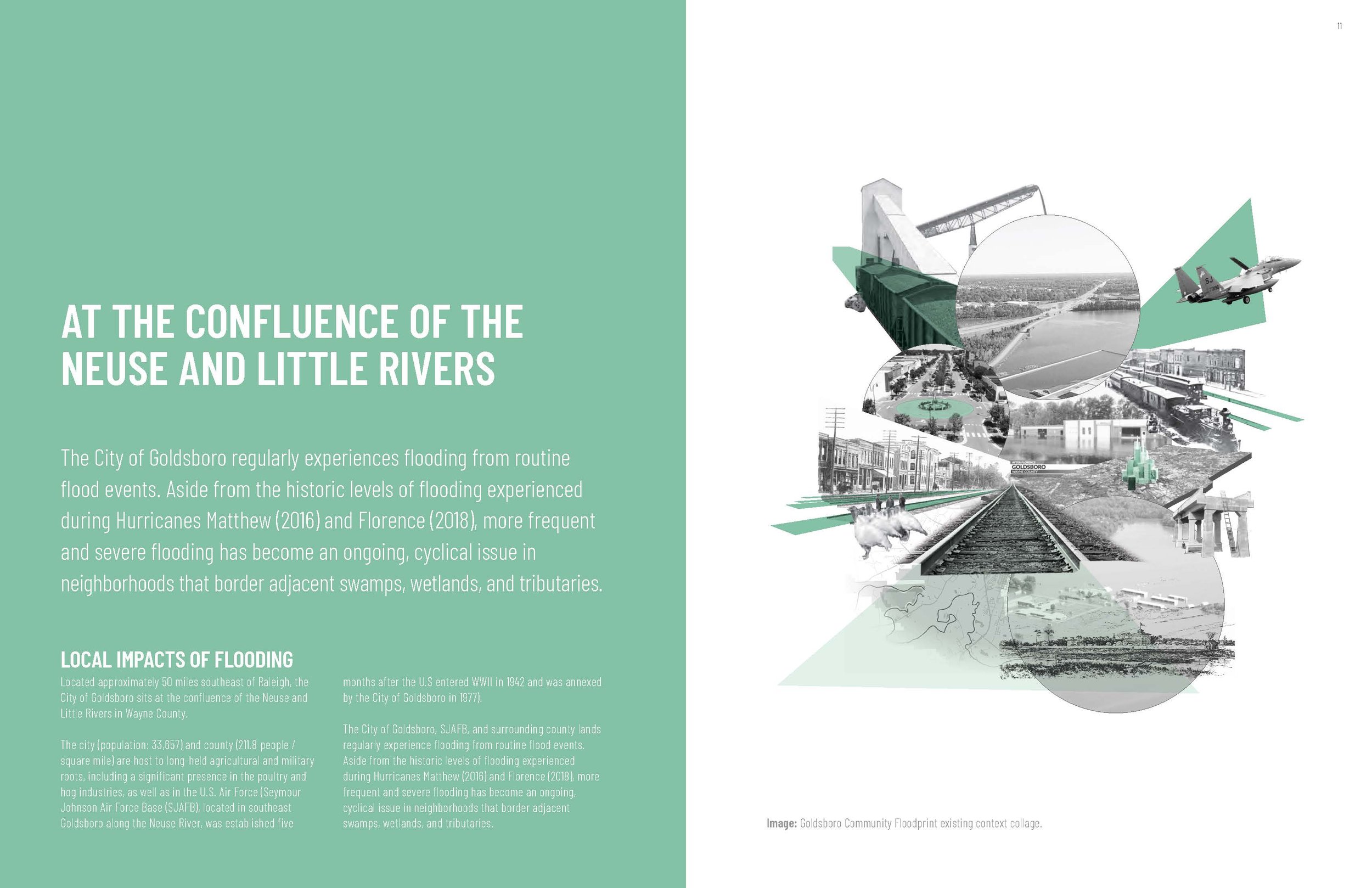
The City of Goldsboro regularly experiences flooding from routine flood events. Aside from the historic levels of flooding experienced during Hurricanes Matthew (2016) and Florence (2018), more frequent and severe flooding has become an ongoing, cyclical issue in neighborhoods that border adjacent swamps, wetlands, and tributaries.
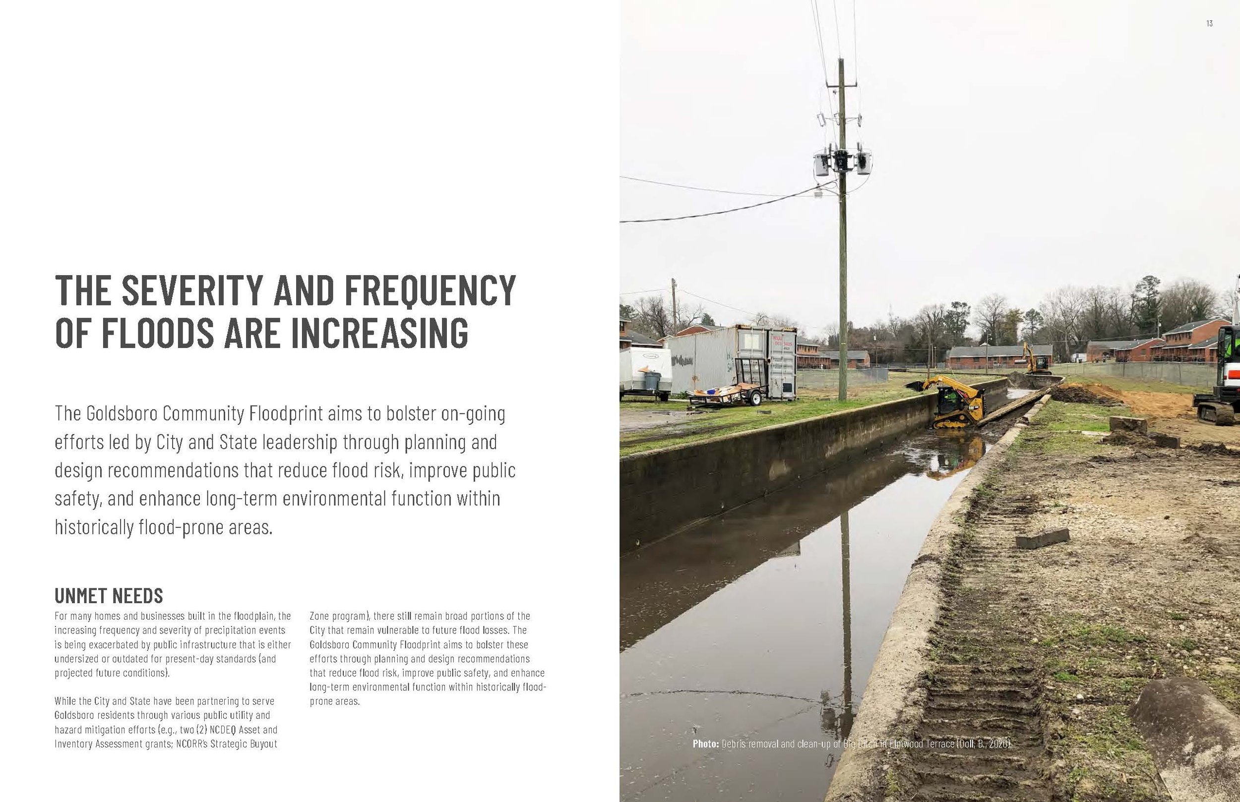
For many homes and businesses built in the floodplain, the increasing frequency and severity of precipitation events is being exacerbated by public infrastructure that is either undersized or outdated for present-day standards (and projected future conditions).
While the City and State have been partnering to serve Goldsboro residents through various public utility and hazard mitigation efforts (e.g., two (2) NCDEQ Asset and Inventory Assessment grants; NCORR’s Strategic Buyout Zone program), there still remain broad portions of the City that remain vulnerable to future flood losses. The Goldsboro Community Floodprint aims to bolster these efforts through planning and design recommendations that reduce flood risk, improve public safety, and enhance long-term environmental function within historically flood-prone areas.
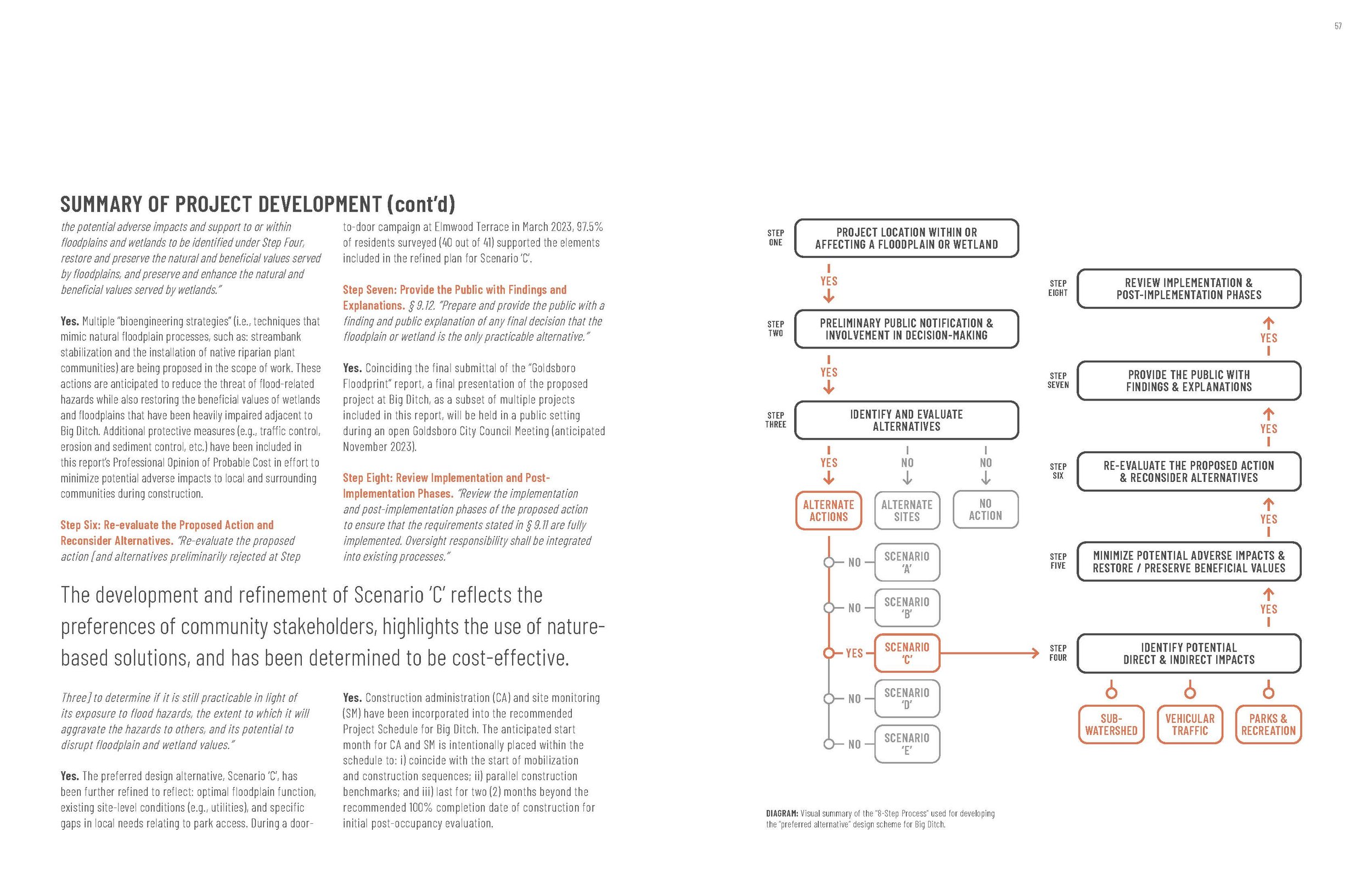
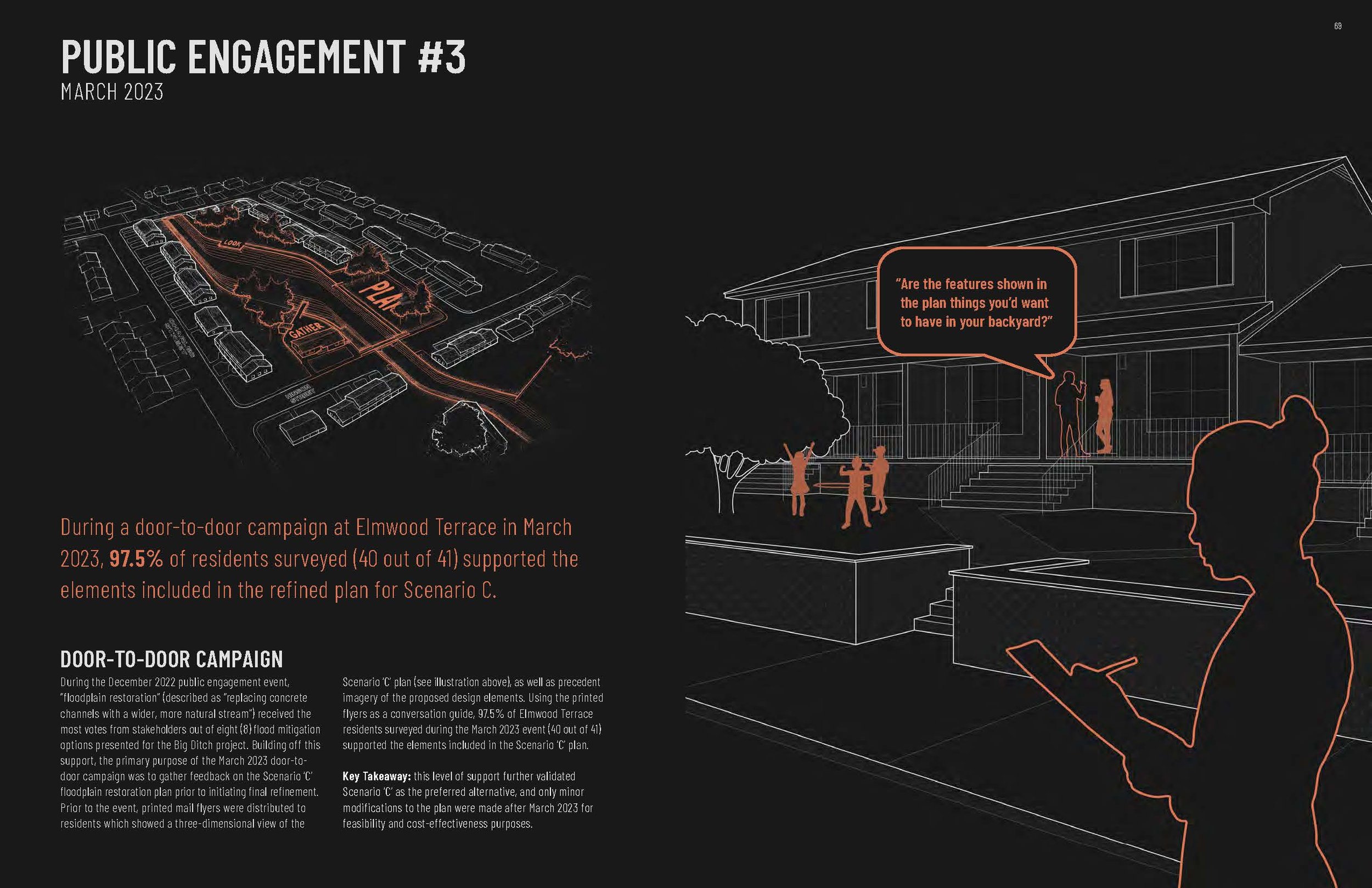
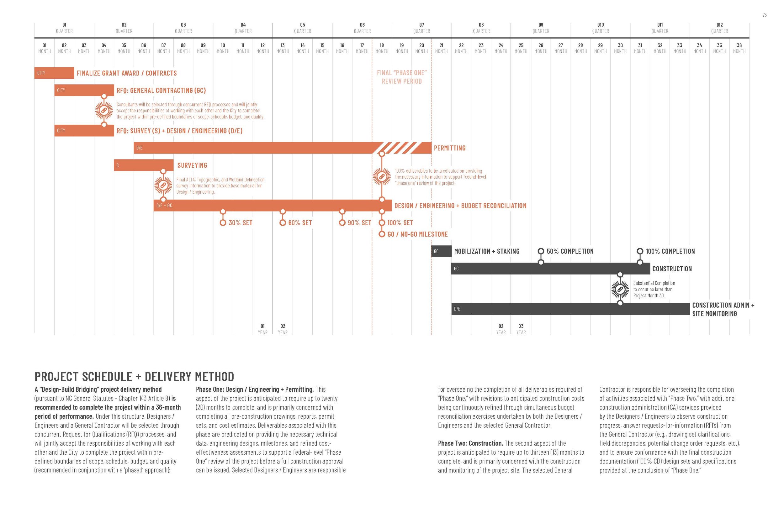
This study used an environmental and community planning approach referred to as “floodprinting,” which specifically highlights the use of place-based approaches as a response to natural hazards and climate change. As part of the Goldsboro Community Floodprint, discrete project phases and scope items included: inventory and analysis, public outreach and engagement, hydraulic modeling schematic planning and design, three-dimensional modeling, photorealistic rendering, benefit-cost analysis, and grant-writing.
Created over a 16-month project period, the resulting document is meant to both provide direction regarding feasible and sustainable practices within the identified focus areas, while also providing actionable collateral that can be used to attract external resources (e.g., competitive grants) towards these projects. An abbreviated summary of the proposed projects included in the Goldsboro Community Floodprint include:
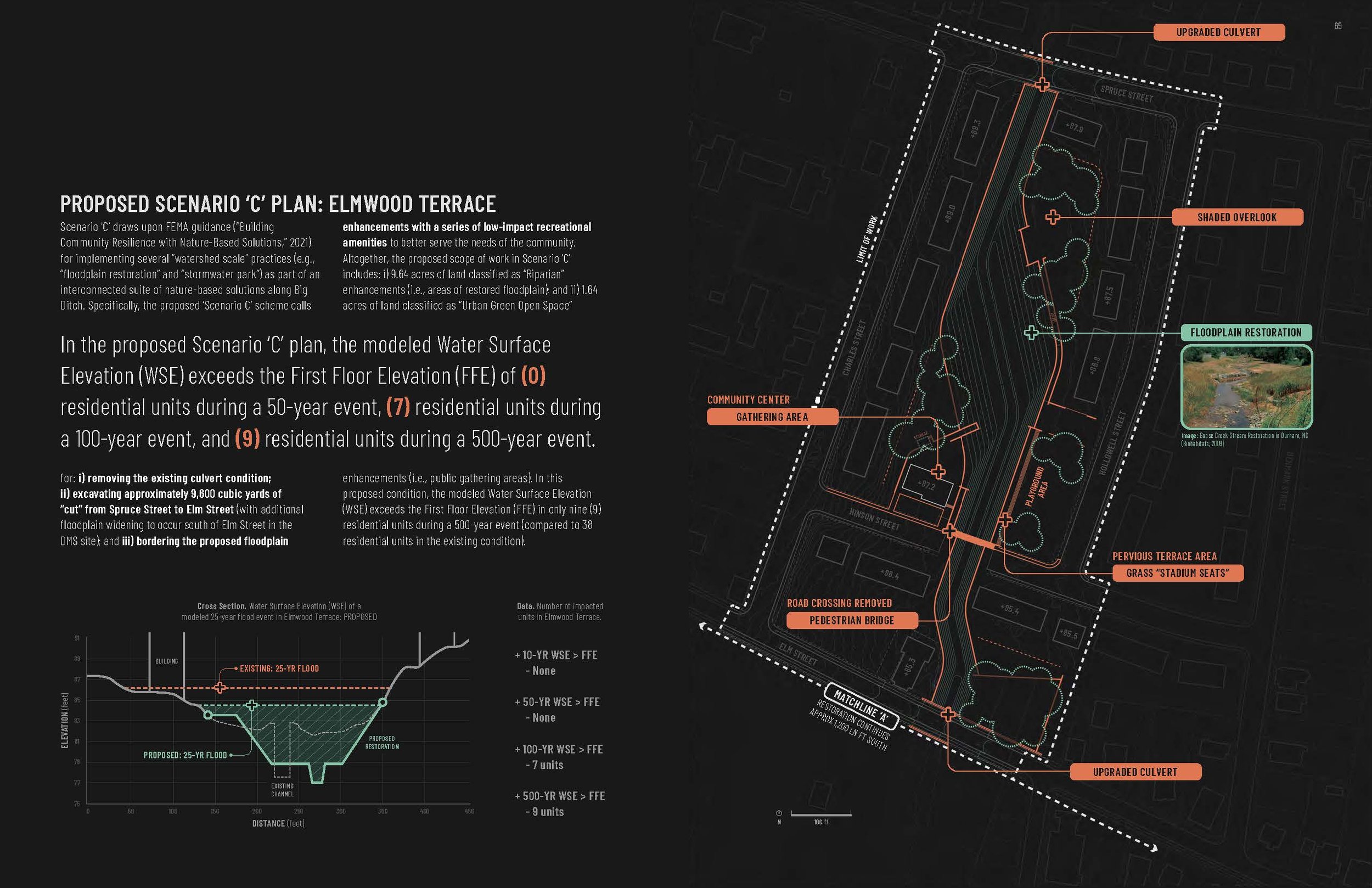
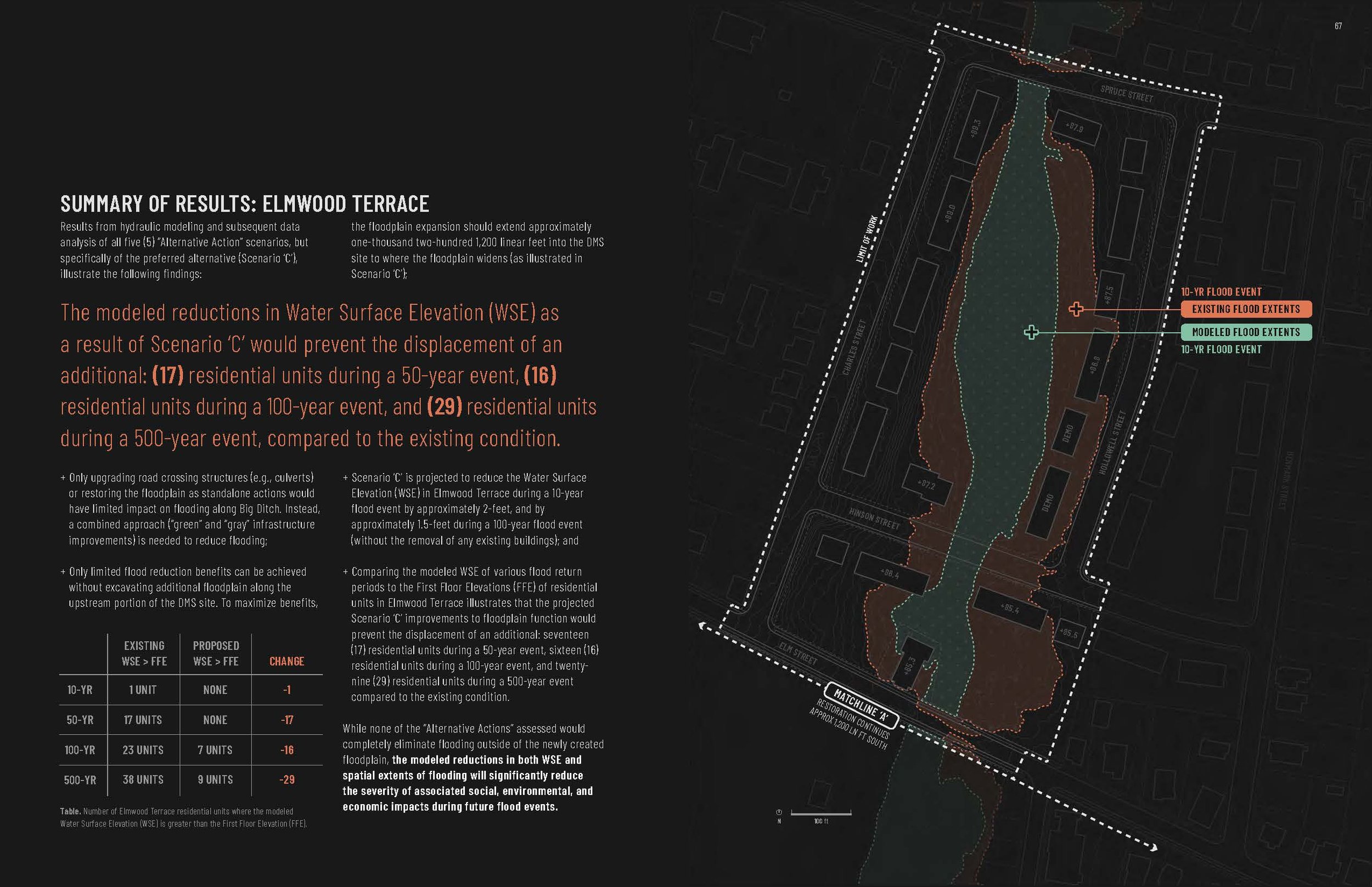
Big Ditch: Stream Restoration + Infrastructure Improvements
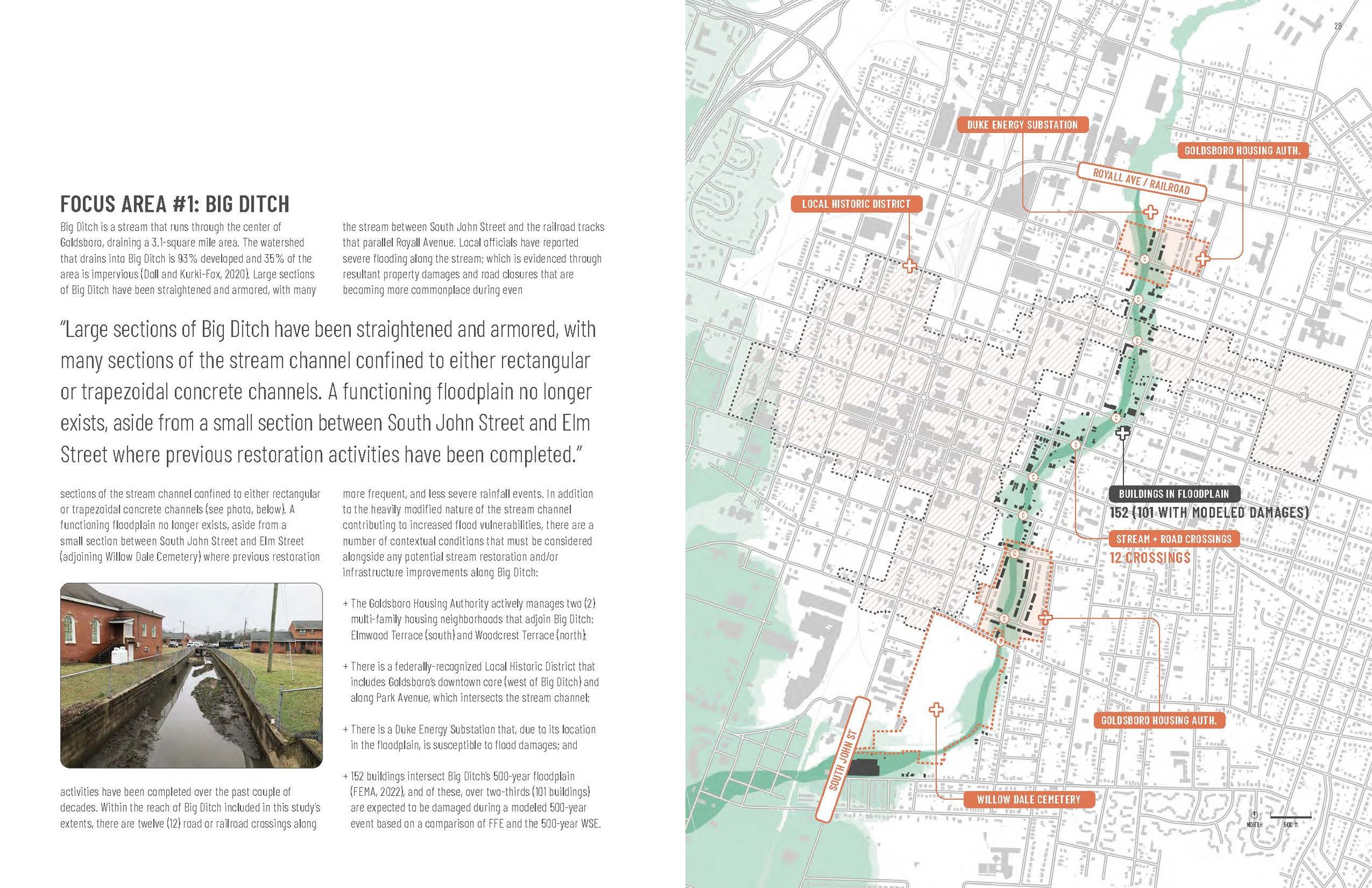
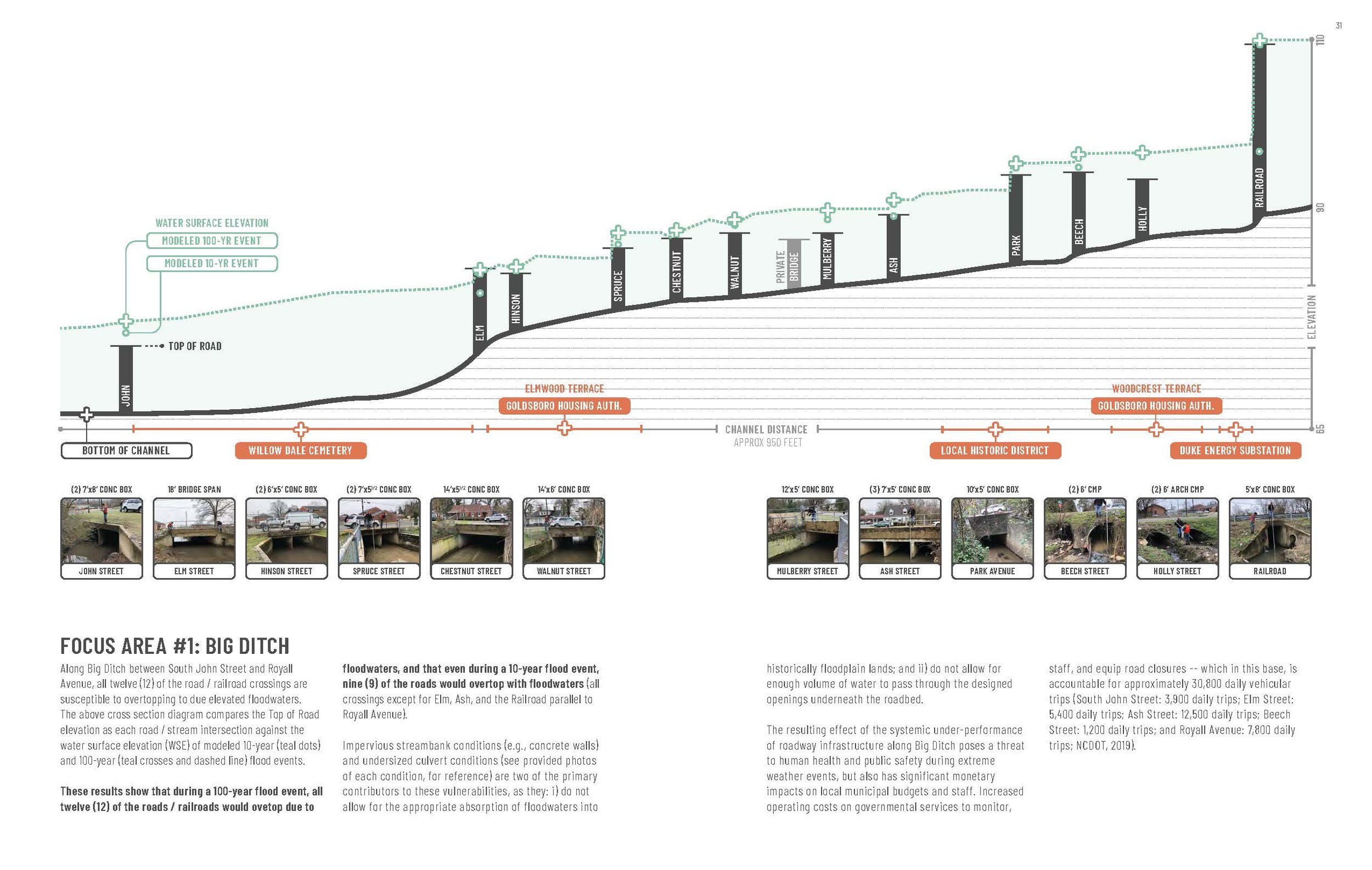
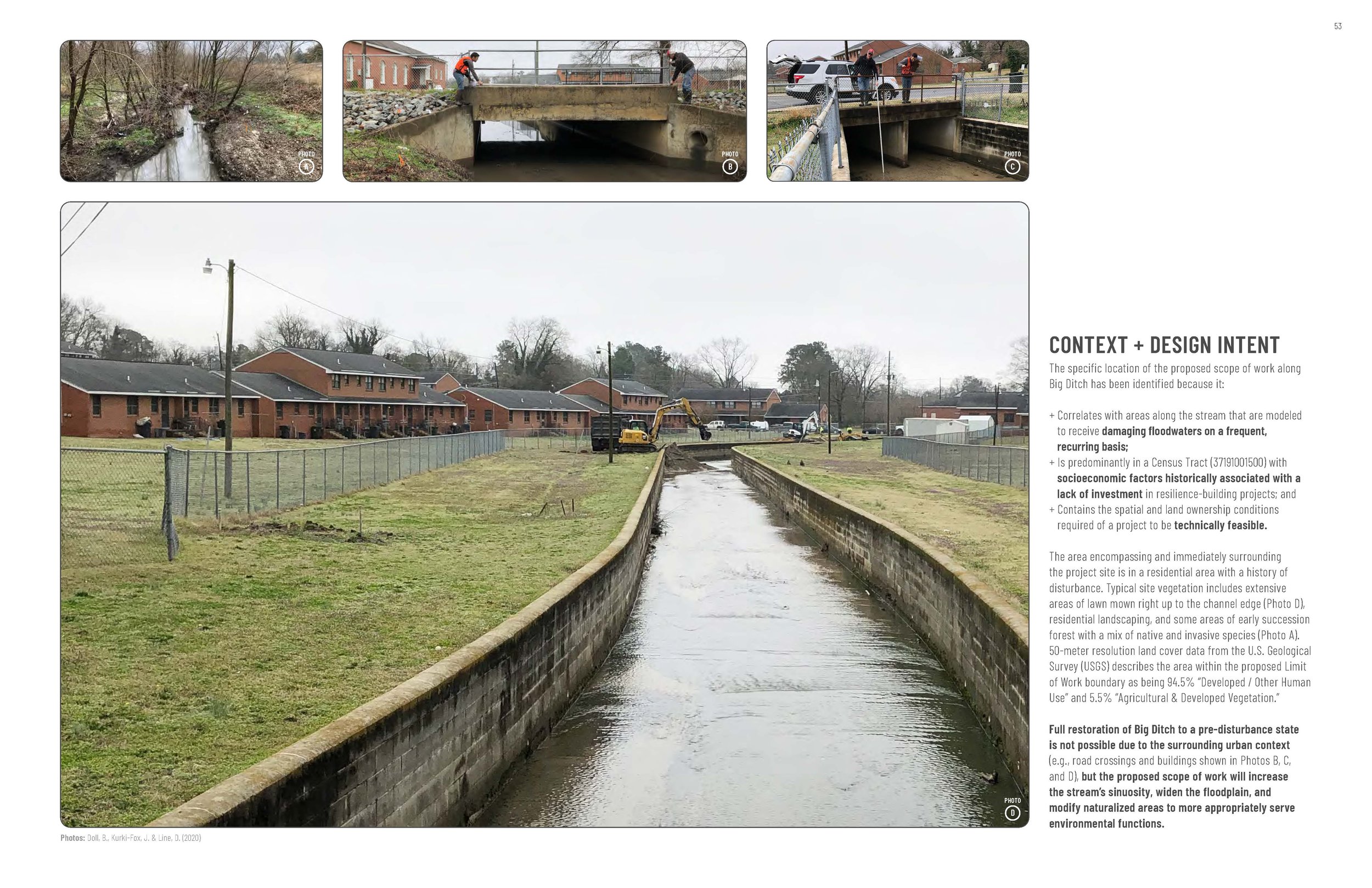
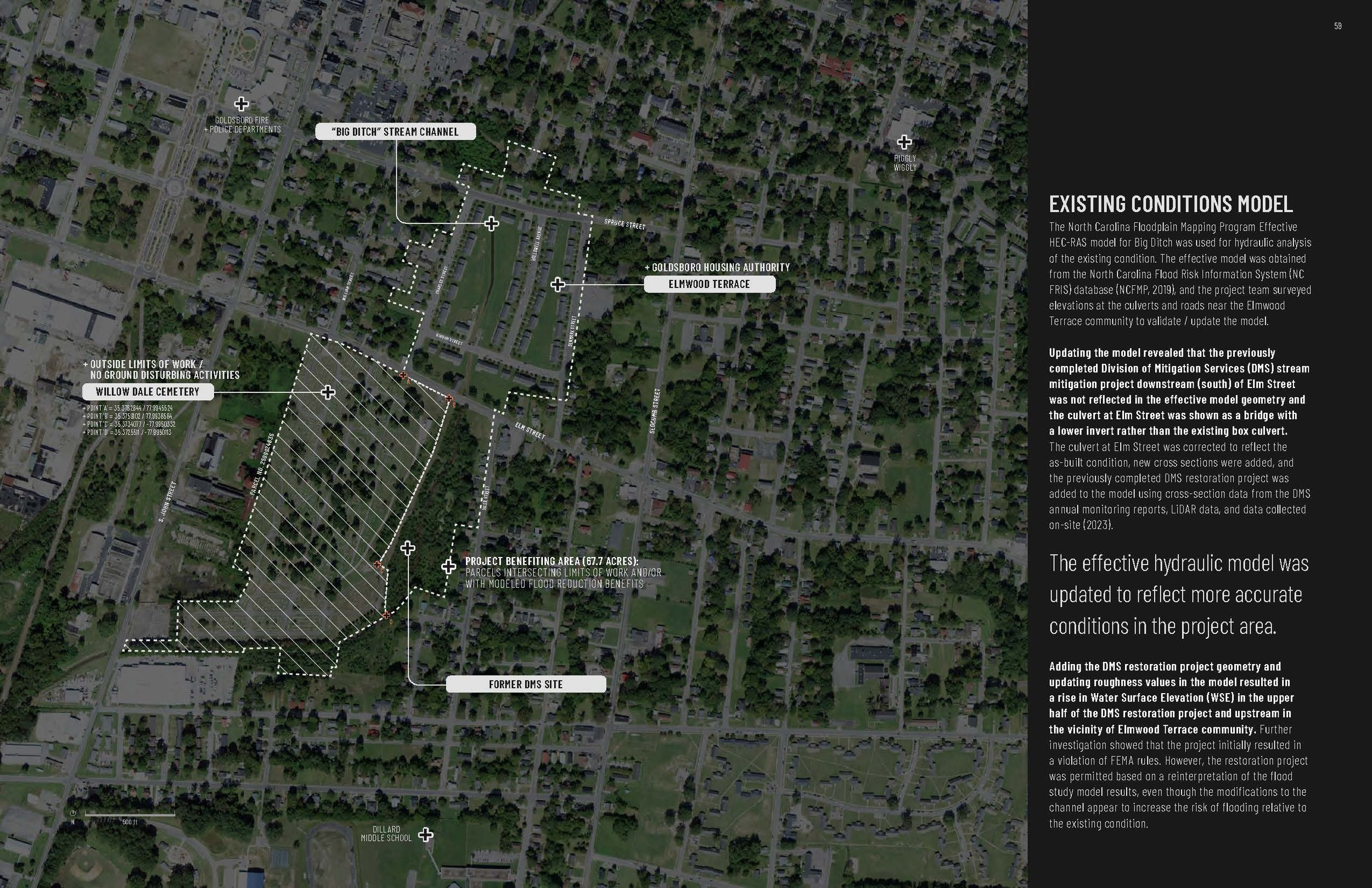
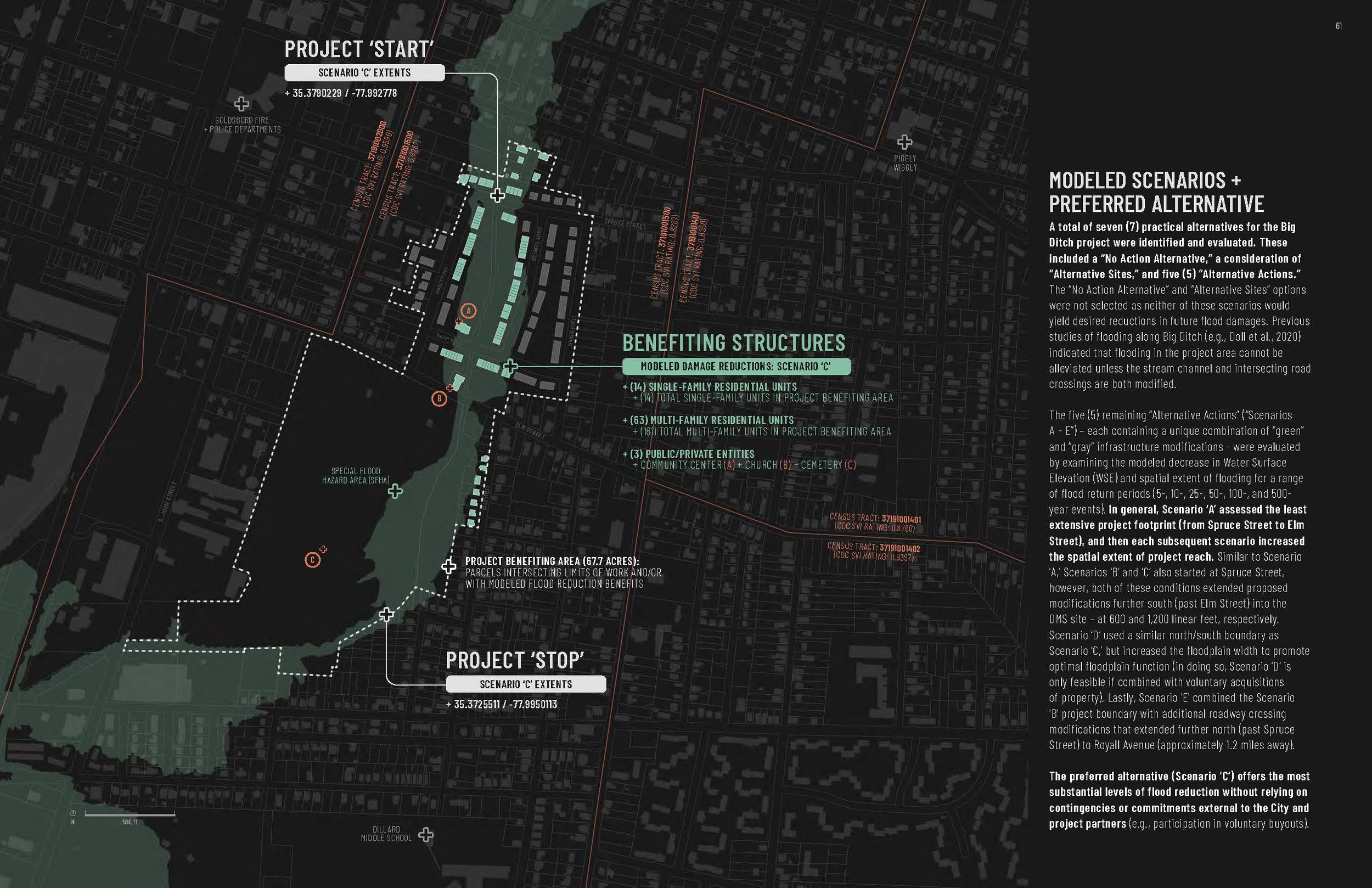
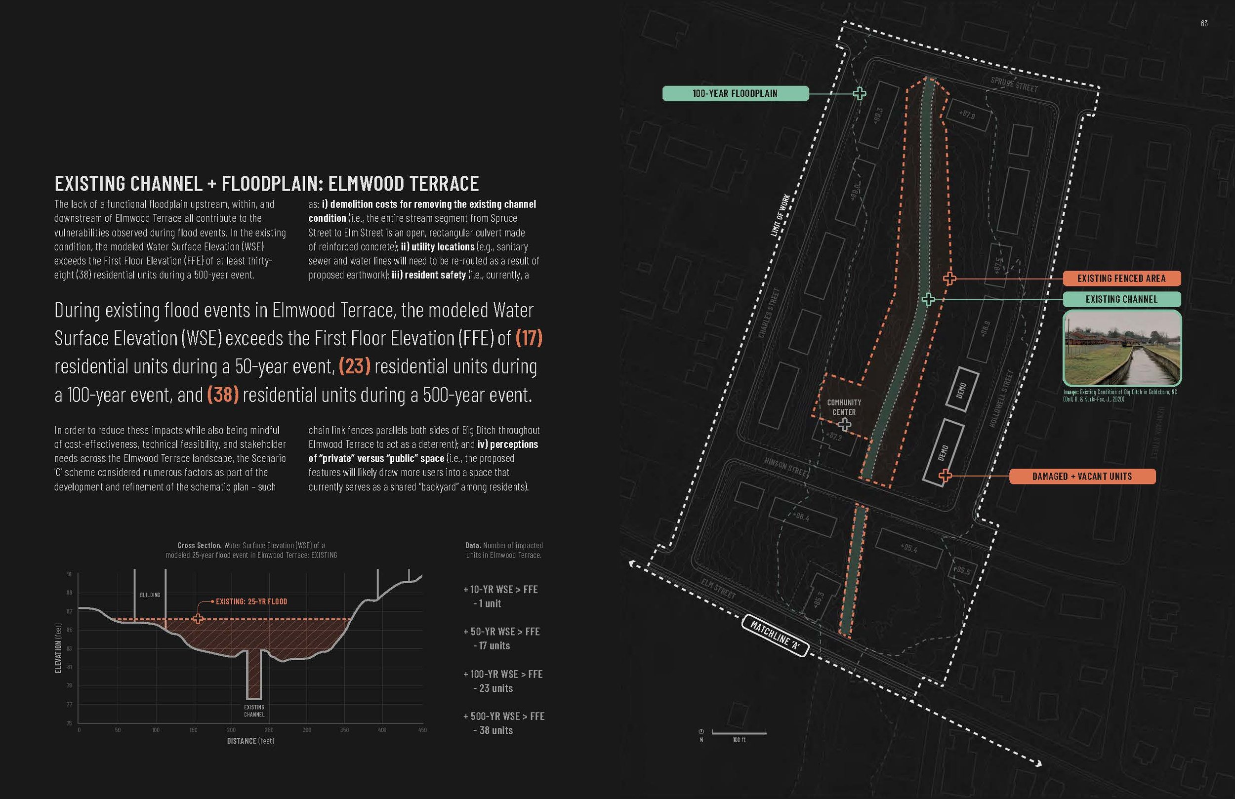
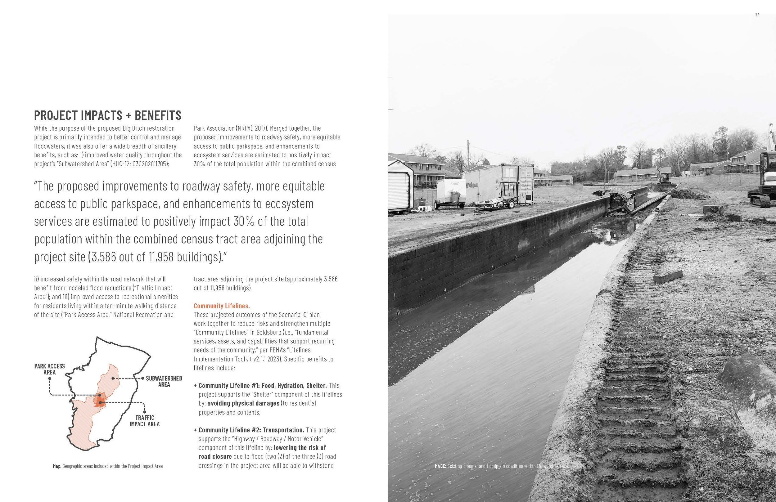
Large sections of Big Ditch have been straightened and armored, with many segments of the stream channel confined to either rectangular or trapezoidal concrete channels. A functioning floodplain no longer exists for most of the stream, which results in a wide range of social, environmental, and economic impacts that cascade through the community.
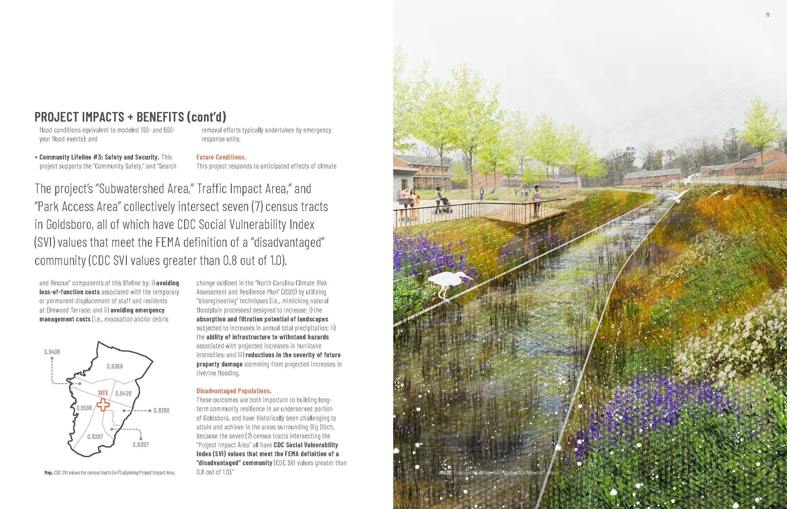
This project will: i) restore approximately 2,300 linear feet of stream; ii) upgrade three (3) culvert/bridge conditions; and iii) create a “floodplain park” within the Elmwood Terrace community that borders Big Ditch. Hydraulic modeling of the proposed scope of work indicates that these improvements will reduce flood-related damages throughout the project area. Specifically, (14) single-family residential units, (63) multi-family residential units, and (3) public/private entities will benefit from reductions in projected flood heights, and, two (2) of the three (3) road crossings will be able to withstand flood conditions equivalent to modeled 100- and 500-year flood events.
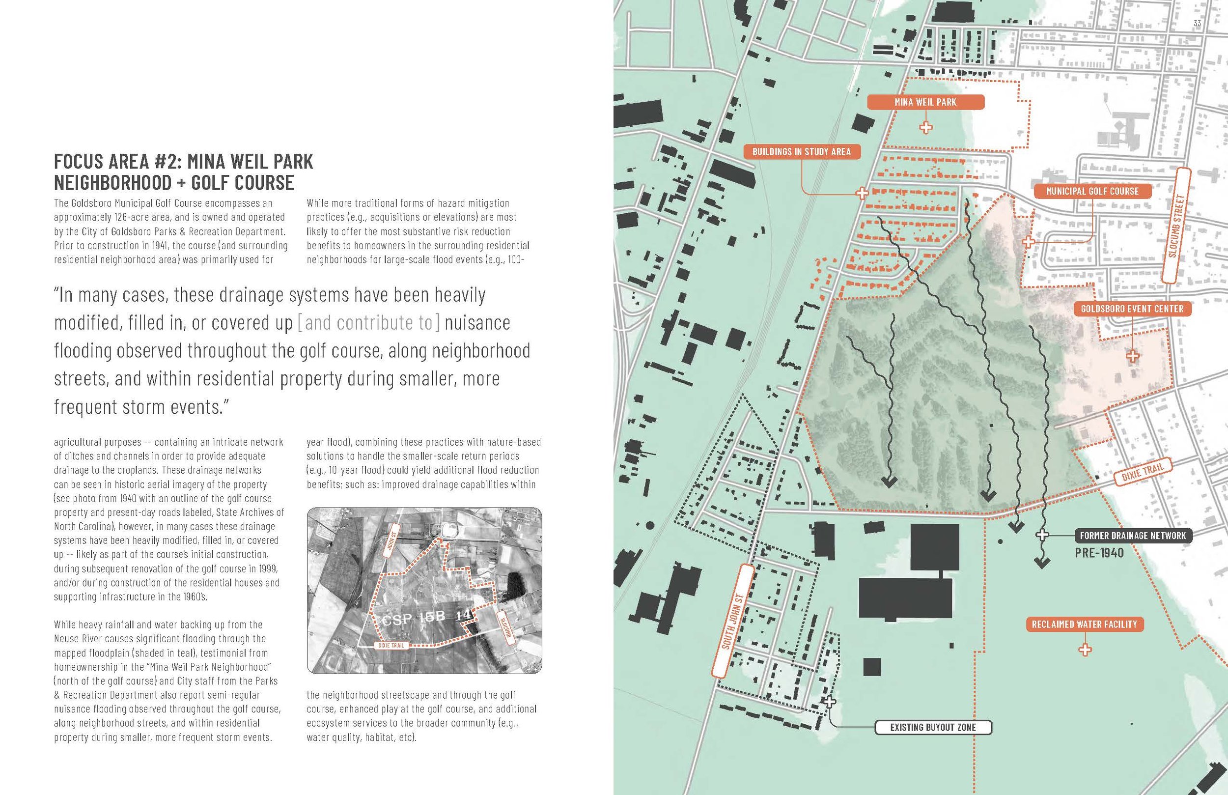
Municipal Golf Course: Low Flow Wetlands
Prior to the construction of the Municipal Golf Course in 1941, the course and surrounding residential areas were used primarily for agricultural purposes - containing an intricate network of ditches and channels that served as a drainage system for croplands. In many cases, however, these important drainage systems have been heavily modified, filled in,
or covered up, and now contribute to nuisance flooding observed throughout the golf course, along surrounding neighborhood streets, and within residential properties during smaller, more frequent storm events.
The proposed intervention calls for daylighting, widening, and vegetating two (2) previously buried drainage channels within the golf course property. The connected chain of linear wetlands, when combined with infrastructure improvements at inlet and outlet locations of the site, will: i) reduce nuisance flooding in the residential neighborhood north of the golf course; ii) improve drainage within the golf course; iii) enhance water quality prior to infiltrating the ground or discharging south of the golf course; and iv) enrich over 11.4 acres of newly established wildlife habitat at a property located within the Neuse River floodplain.
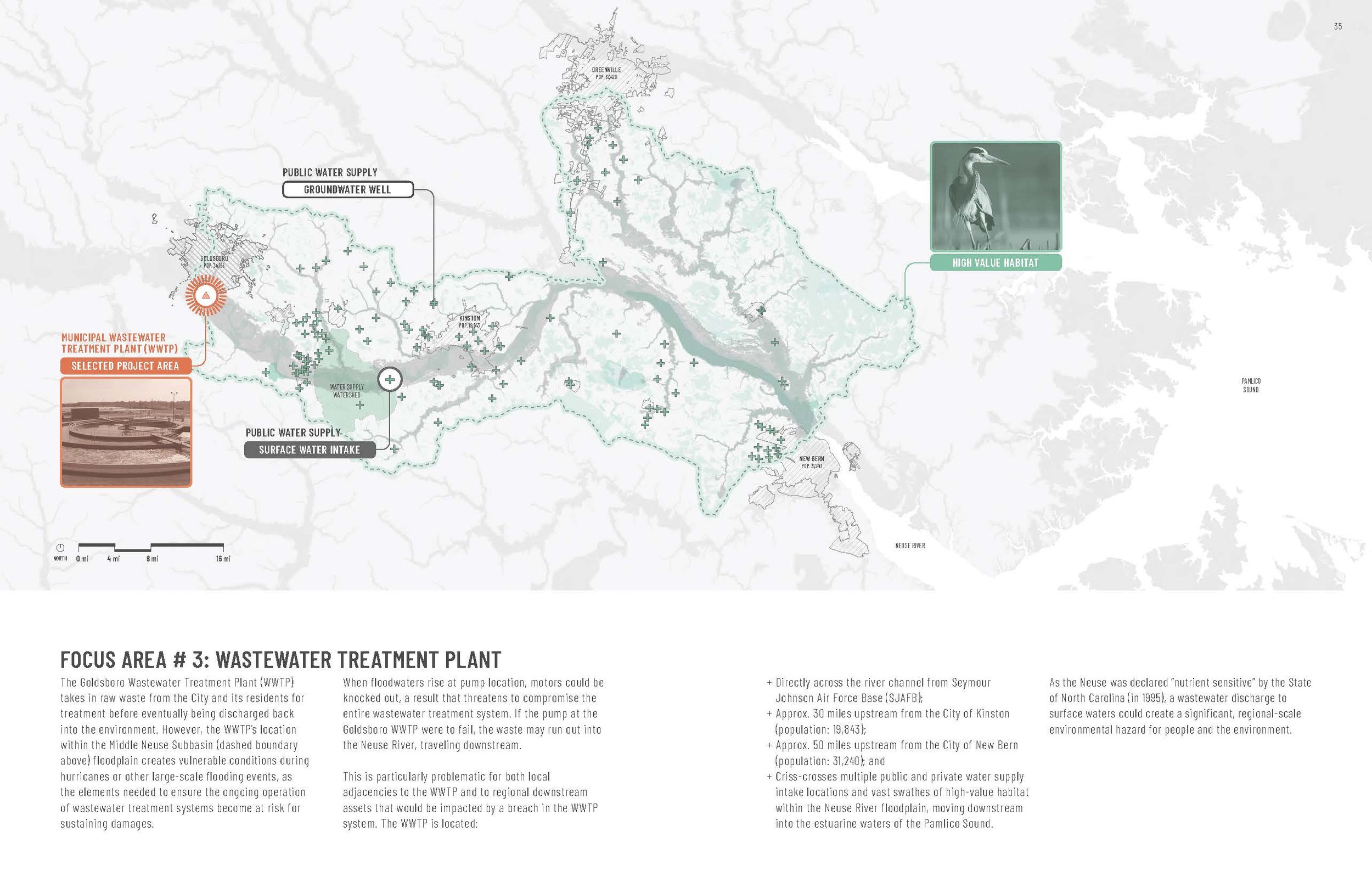
Wastewater Treatment Plant (WWTP): Project Scoping for a Flood Mitigation + Feasibility Study
The WWTP is a public infrastructure facility operated by the City of Goldsboro which treats raw waste from the City, its residents, and Seymour Johnson Air Force Base (SJAFB). However, the WWTP’s location within the Neuse River floodplain presents vulnerable conditions during hurricanes and other large-scale flooding events, as the elements needed to ensure the ongoing operation of wastewater treatment systems become susceptible to damages, and potentially, system failure. An incidental wastewater discharge to surface waters would result in a significant environmental hazard affecting people, the environment, and military operations.
The need for a flood mitigation and feasibility study has been determined as an appropriate next step to better understand potential mitigation alternatives and their associated trade-offs. As part of this report, major scope elements required of a potential flood mitigation study for the WWTP have been identified, including the: i) development of a preliminary opinion of consultant fee ranges; ii) identification of major qualifications and criteria for selecting prospective consultants; and iii) integration of scope, fee, qualifications, and selection criteria into a draft Request for Qualifications (RFQ) solicitation.
A summary of the final report was presented to Goldsboro’s City Council on November 6, 2023, where a vote to support the recommendations within the Goldsboro Community Floodprint was approved via City Resolution No. 2023-84.
Project Start Year
2022
Client
City of Goldsboro
Location
Goldsboro, NC
Collaborators
Hydraulic Modeling (Big Ditch + Municipal Golf Course): Barbara Doll, PhD, PE, and Jack Kurki-Fox, PhD, PE
Cost Estimating (Big Ditch) + Wastewater Treatment Plant Consulting: Gresham Smith
Full Report
Funding Sources
North Carolina Office of Recovery and Resiliency (NCORR) / U.S. Department of Housing and Urban Development (HUD) CDBG-Mitigation Grant
Awards
2024 Merit Award in Analysis & Planning: Goldsboro Community Floodprint, North Carolina Chapter of the American Society of Landscape Architects
Related Project
Sample Images