Project Summary
OVERVIEW
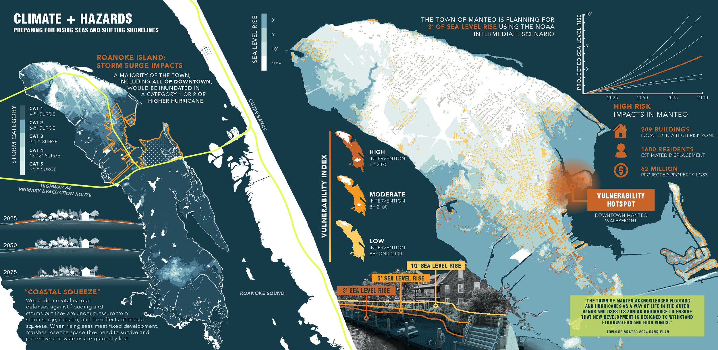
The 2025 Coastal Dynamics Studio was focused on designing and testing sea level rise scenarios to inform long-range planning of at-risk areas of Town of Manteo, NC.
CONTEXT
Situated between the mainland coast of North Carolina and the Outer Banks, the Town of Manteo is located on Roanoke Island. By 2025, sea levels are projected to rise by three feet, which will inundate 55% of Roanoke Island’s land area and displace 650 structures. Despite these coastal hazards, Manteo’s population continues to grow. Tourism fuels the demand for second homes, inflating housing costs. These issues are further compounded by stormwater and wastewater systems nearing capacity.
PROJECT VISION
The Town of Manteo adopted its new 20-year Comprehensive Plan and CAMA Land Use Plans in 2024. While acknowledging climate risks, the plans provided no guidance on strategies and possible solutions to explore and guide future adaptation and mitigation actions.
The goal of this studio was to help increase social and physical resilience within the town limits and in county-controlled areas of Roanoke Island. Students achieved this by exploring strategies that reduce flood risk, improve public safety, enhance long-term ecological function, promote environmental and cultural education, and confront affordability issues within the town’s historically flood-prone areas. Each of the students’ projects considered both current conditions and projected future climate scenarios (3’-7’ of SLR, depending on tidal and/or storm conditions). The interventions proposed by the students and processes enabled by the conintued partnership between the Town of Manteo and the CDDL are prioritizing current and future needs and, as a result, leading to the co-creation of an actionable strategic plan that is guiding future investments.
Funding Source
Town of Manteo (Direct Sponsor), funded by a State of North Carolina Department of Commerce: Rural Community Capacity Building Implementation Grant (Prime Sponsor)
Sample Images