Brunswick + New Hanover Counties, NC
Eagles Island Studio (2022)
Project Summary
OVERVIEW
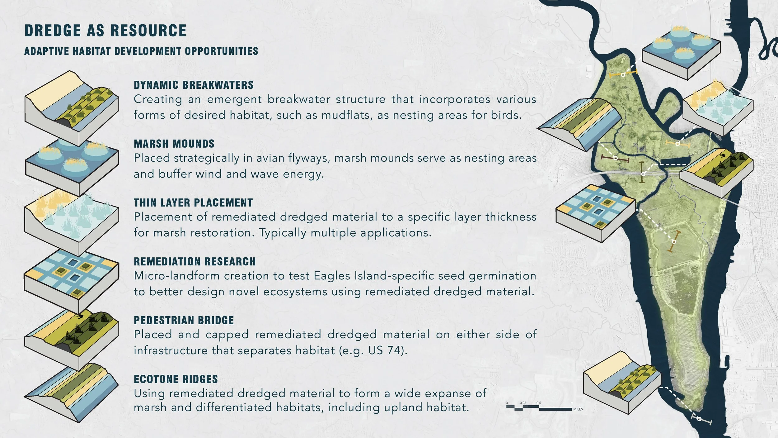
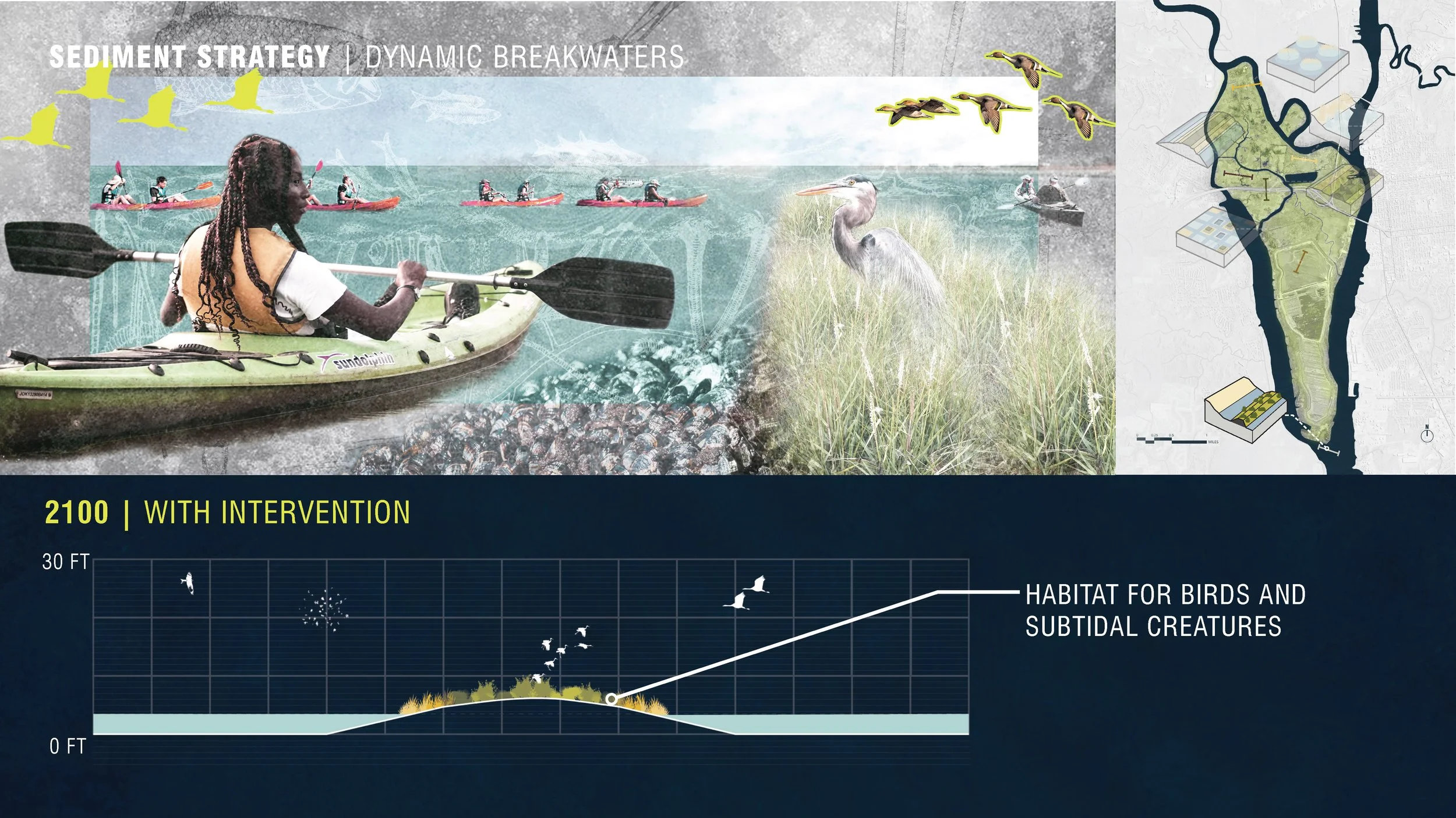
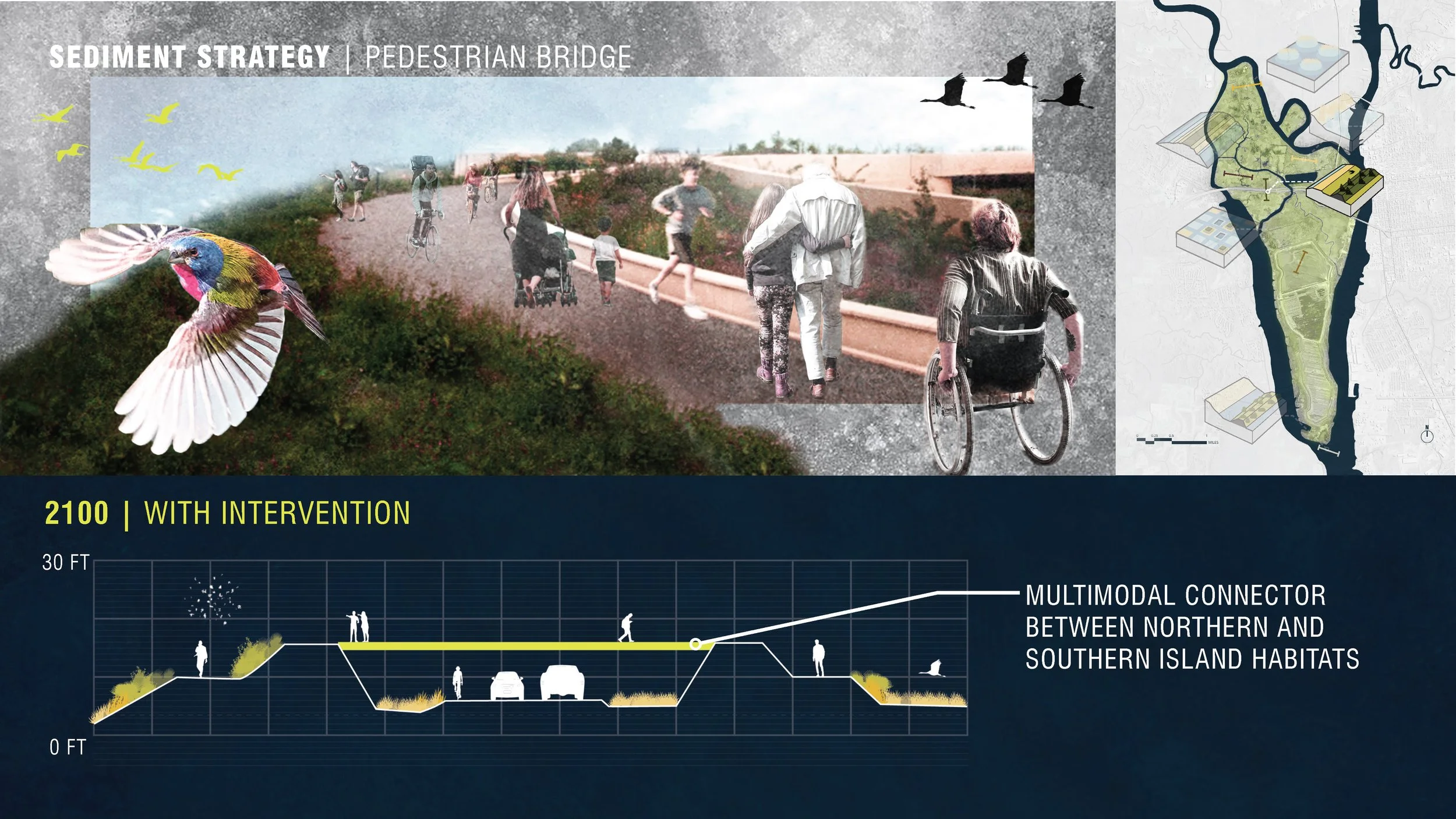
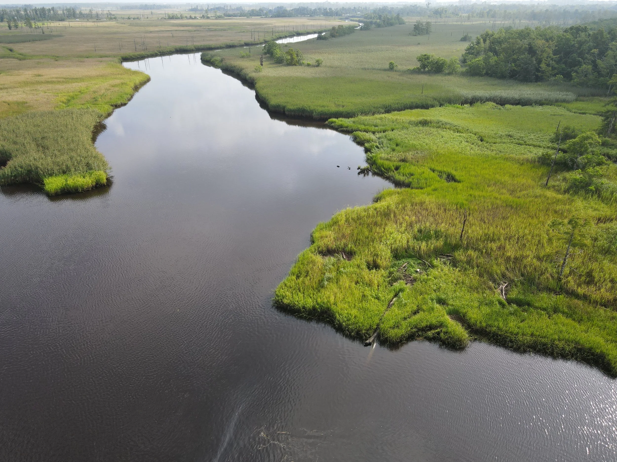
Eagles Island first appeared on North Carolina maps in 1671—known then as Cranes Island. Located at the confluence of the Cape Fear and Brunswick Rivers, Eagles Island has been a vital ecological asset within this riverine system and a centerpiece of the dynamic cultural history of the region. The approximately 3,110-acre island is located roughly 22 miles upriver from the mouth of the Cape Fear. On the eastern side of the island, downtown Wilmington lies just across the Cape Fear River. On the western side, Belville, Leland, and Navassa are located just across the Brunswick River. Over the years, Eagles Island has supported surrounding populations through the provision of natural resources (hunting, fishing, and timbering) and has seen agricultural (rice) and industrial (naval stores and shipping) uses. Currently, almost 1,500 acres in the southern area of the island are managed by the US Army Corps of Engineers as a disposal site for dredge spoils, and this area is also used as habitat by myriad shorebirds. To the north, where portions of the island are in conservation, the tidal freshwater marsh habitat is designated as a Natural Heritage Program Natural Area, and remnants of hand-dug ditches and canals reveal the island’s history as a significant agricultural site for rice cultivation. Sunken and abandoned vessels along the eastern shore of the island tell the story of Wilmington’s economic growth and industrial past.
The 2022 Coastal Dynamics Studio focused on aspects of designing in coastal environments. This studio included students and faculty from the Department of Landscape Architecture + Environmental Planning and School of Architecture. Students consulted with stakeholders in Wilmington and with practitioners from our partnering firm, Hanbury. Projects requireed both team and individual work.
Awards
2023 1st Place Winner (Design): Dredge Ecologies: Climate-Adaptive Strategies for a Changing Island in a Changing Climate (Marybeth Campeau), 16th Annual North Carolina State University Graduate Student Research Symposium. Advisors of Record: A. Fox and M. Baldwin.
2023 Honor Award in Innovation in Design: Through Line: Establishing a Culture of Collective Stewardship through Landscape (Evan Holliday), American Society of Landscape Architects Southeast Regional Conference. Instructors of Record: A. Fox, D. Hill, and M. Baldwin.
2022 Student Honor Award in Analysis & Planning: Dredge Ecologies: Climate-Adaptive Strategies for a Changing Island in a Changing Climate (Marybeth Campeau), American Society of Landscape Architects. Instructors of Record: A. Fox, D. Hill, and M. Baldwin.
2022 Student Honor Award in Student Collaboration: Fixed in Flux: A World Class Park Embracing Rising Waters (Brian Vaughn, Lauren Joca, Makayla Esposito, Davis Turner, Hassan Shata), American Society of Landscape Architects. Instructors of Record: A. Fox, D. Hill, and M. Baldwin.
2022 Student Award: Eagles Island Nature Park (Rebecca Curry, Marybeth Campeau, Claire Henkel, Maya Miller, Lauren Waterman), North Carolina Chapter of the American Institute of Architects. Instructors of Record: A. Fox, D. Hill, and M. Baldwin.
Project Start Year
2022
Location
Brunswick + New Hanover Counties, NC
Sponsorship Partner
Sample Images