
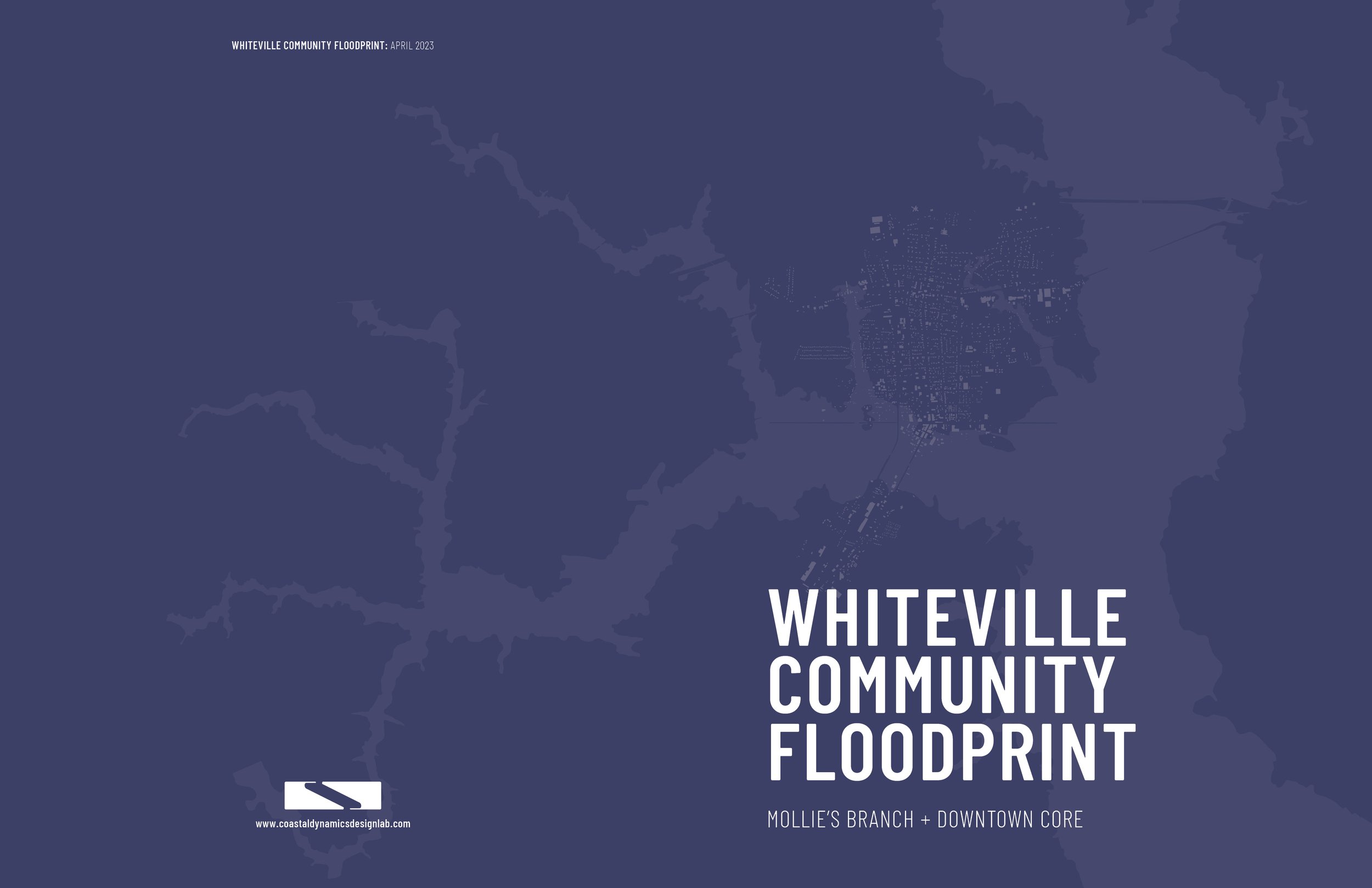
Whiteville Floodprint
Mollie’s Branch + Downtown Core
Project Summary
Purpose of the Project
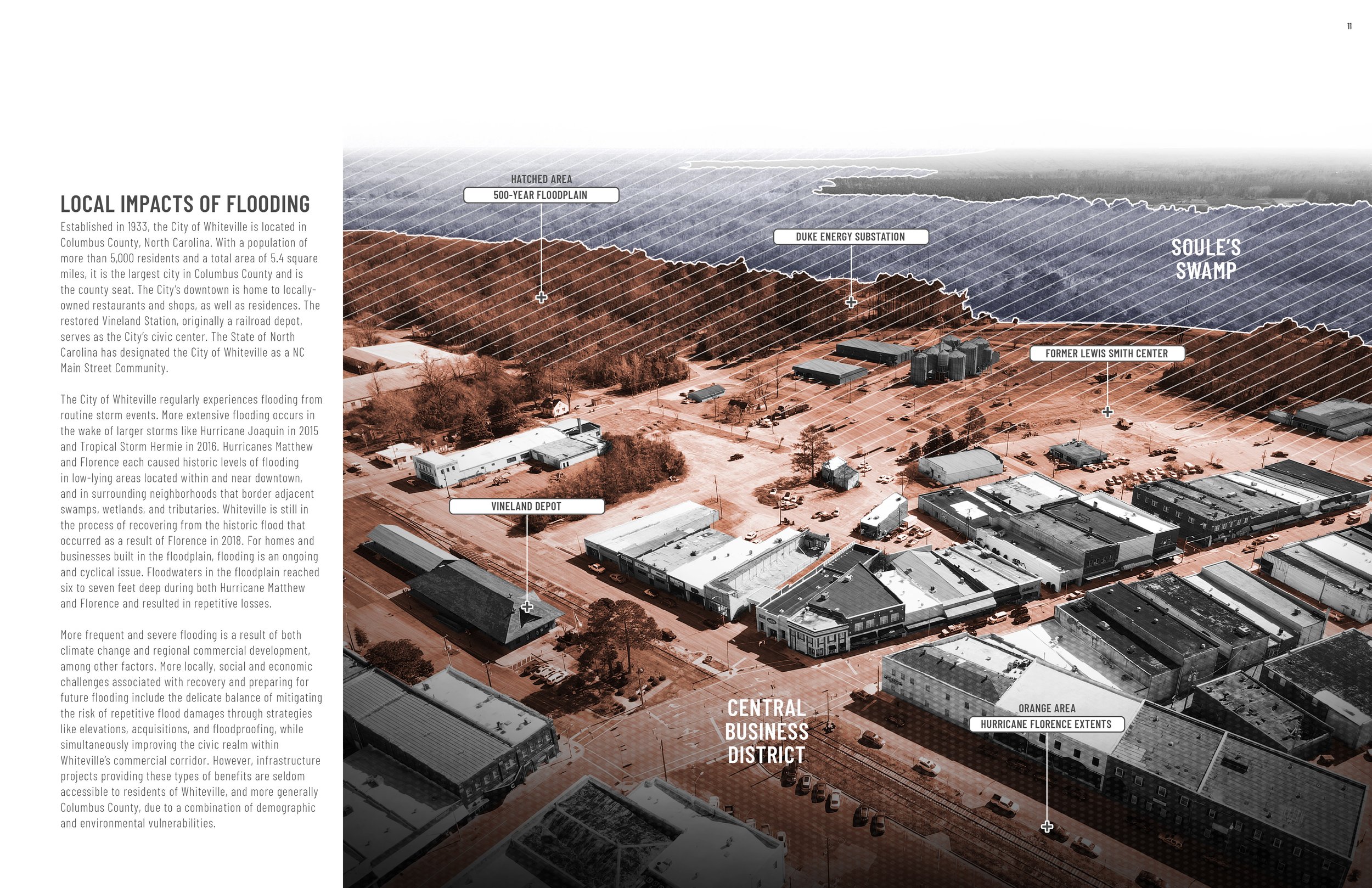
The City of Whiteville is in the process of recovering and rebuilding from the devastating floods that occurred as a result of Hurricane Matthew (2016) and Hurricane Florence (2018), and increasingly, many neighborhoods are becoming more susceptible to recurring flood damages from smaller and more frequent, unnamed storm events.
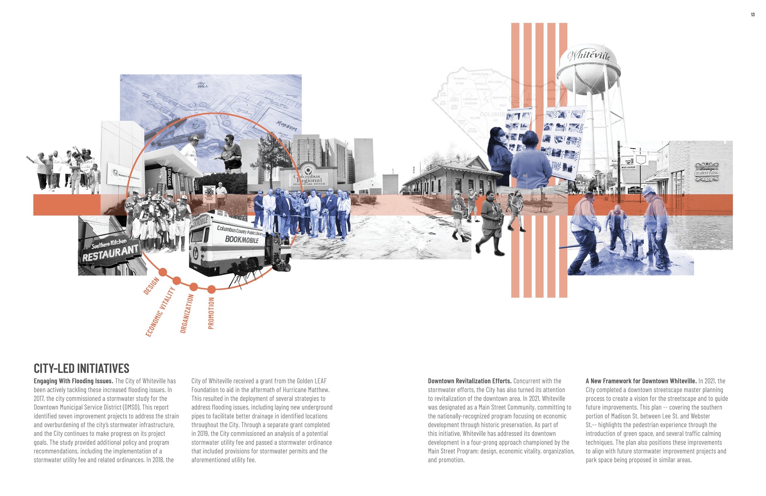
In recent years, the city has taken numerous steps to reduce the severity of future floods. Select properties have been acquired and demolished, a stormwater fee has been implemented, and various drainage improvement projects are currently underway. As the community continues to adapt, the Whiteville Community Floodprint aims to bolster these efforts through planning and design recommendations that reduce flood risk, improve public safety, and enhance long-term environmental function within historically flood-prone areas.
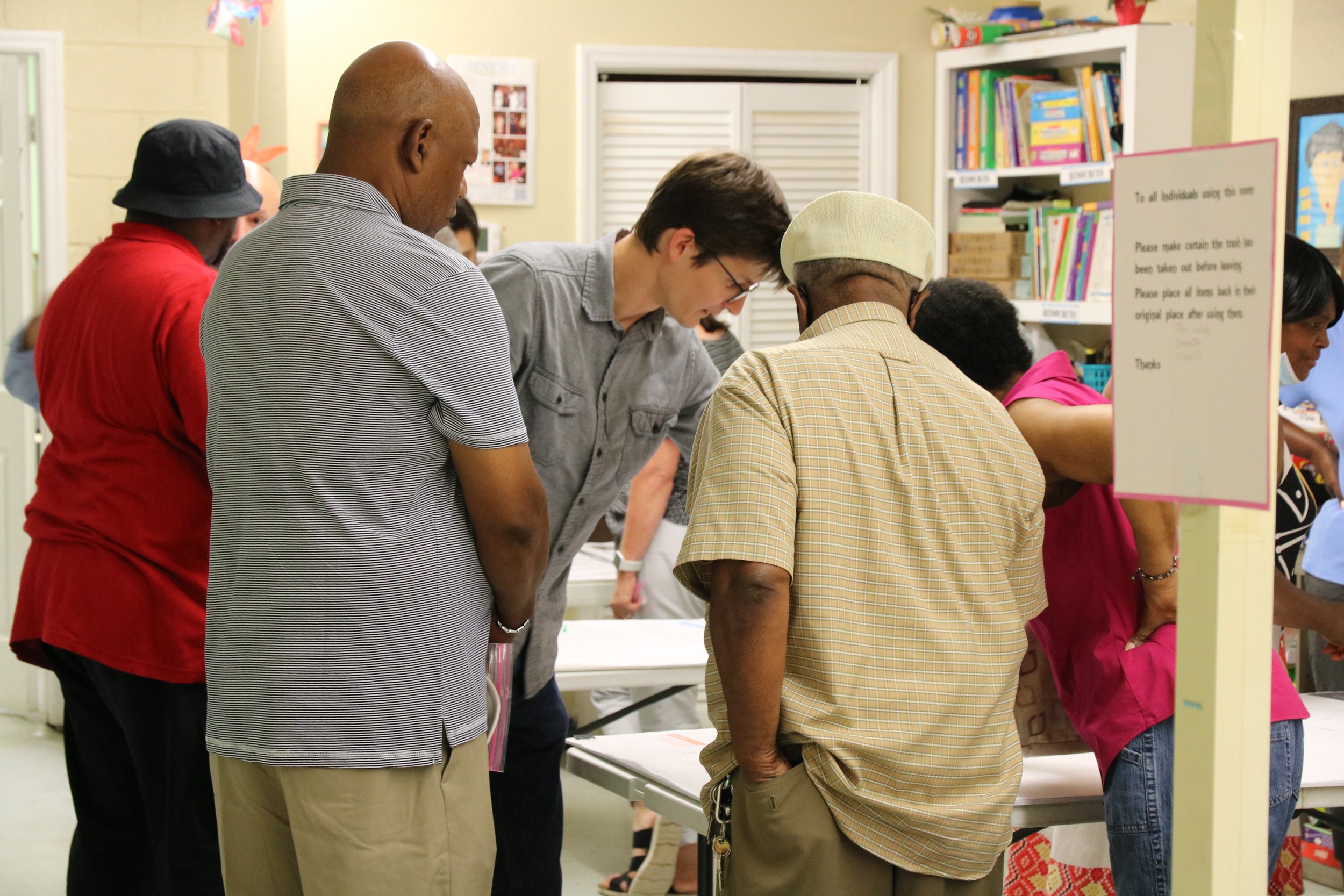
This study used an environmental and community planning approach called “floodprinting,” which highlights the use of place-based approaches to respond to natural hazards and climate change. As part of the Whiteville Community Floodprint, discrete project phases and scope items included: inventory and analysis; public outreach and engagement; hydraulic modeling; schematic planning and design; three-dimensional modeling; photorealistic rendering; benefit-cost analysis; and grant writing.
Created over a 16-month project period, the resulting document is intended to provide direction on feasible and sustainable practices within the identified focus areas, while also serving as actionable collateral to attract external resources to these projects.
An abbreviated summary of the proposed projects included in the Whiteville Community Floodprint includes:
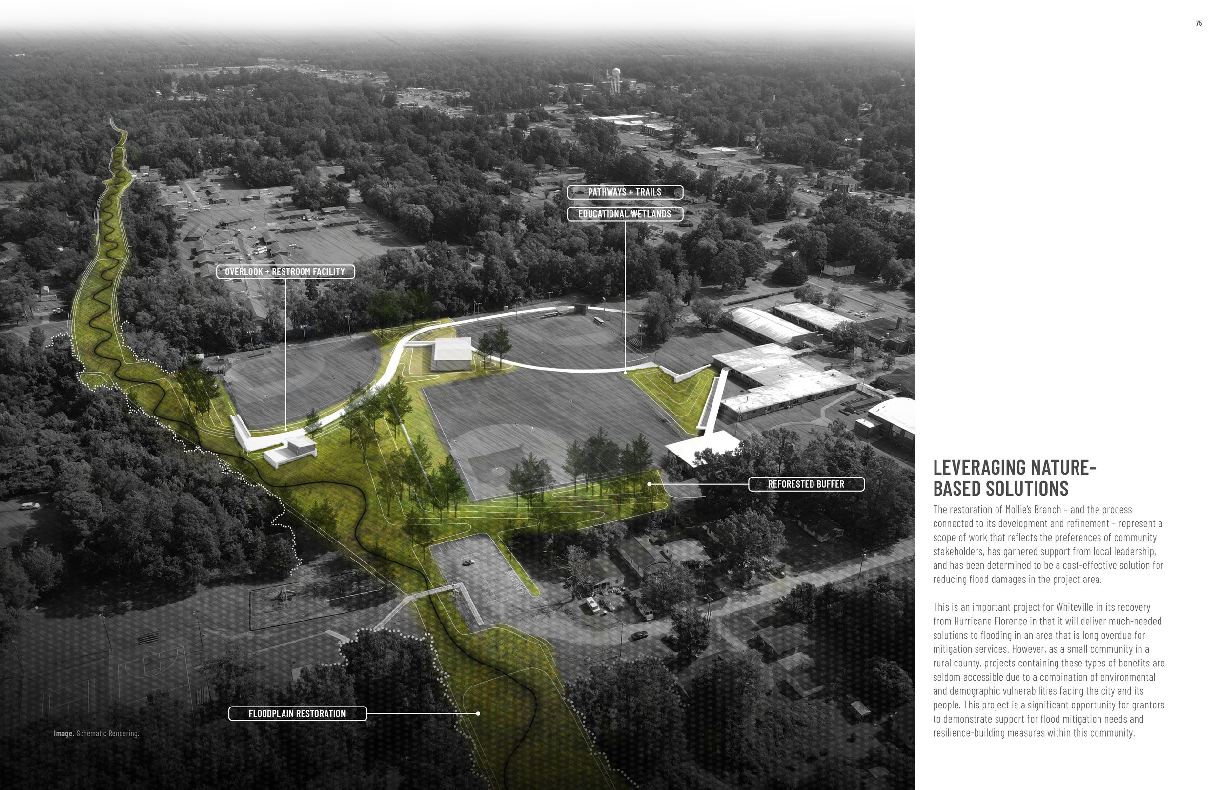
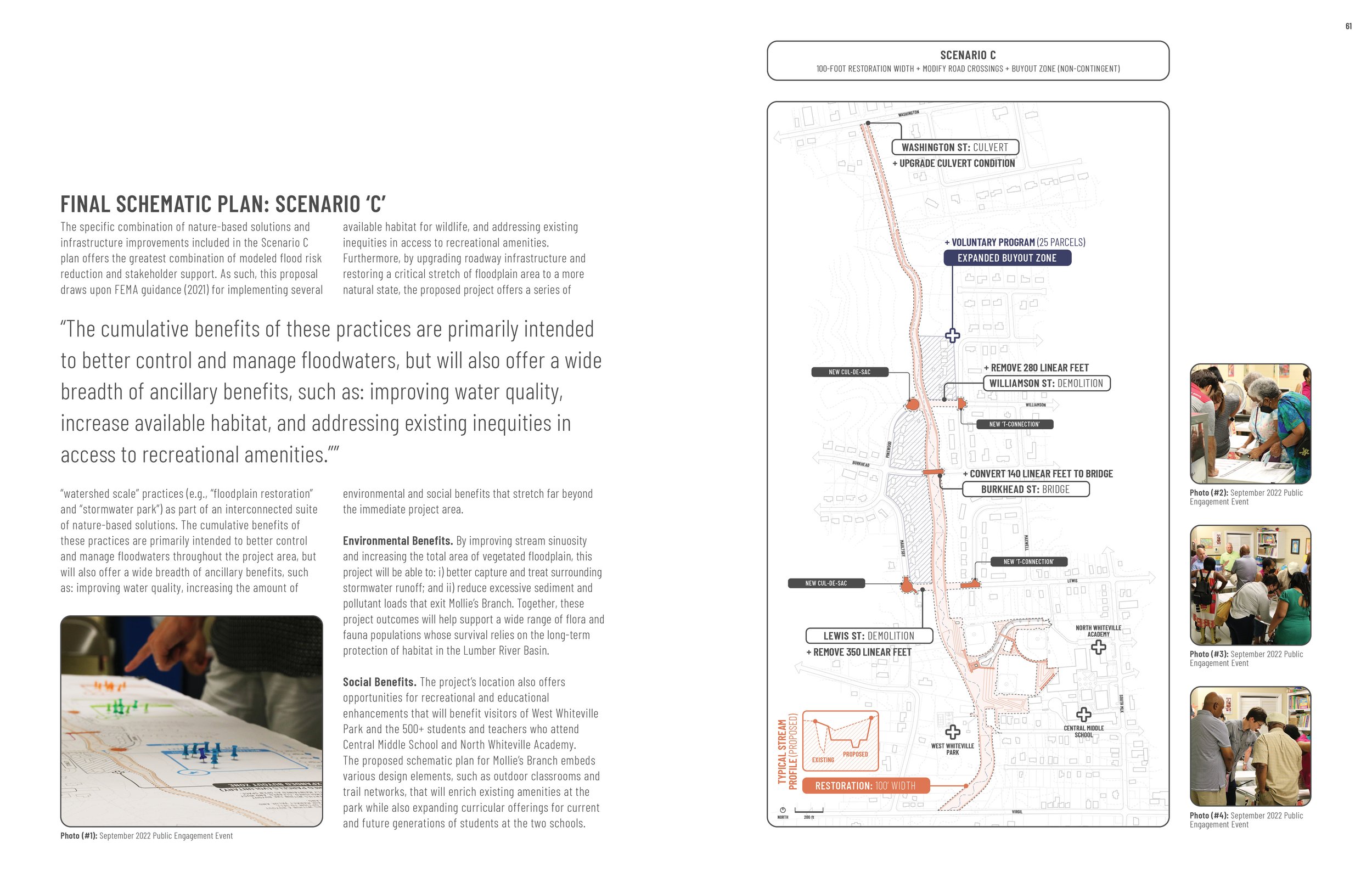
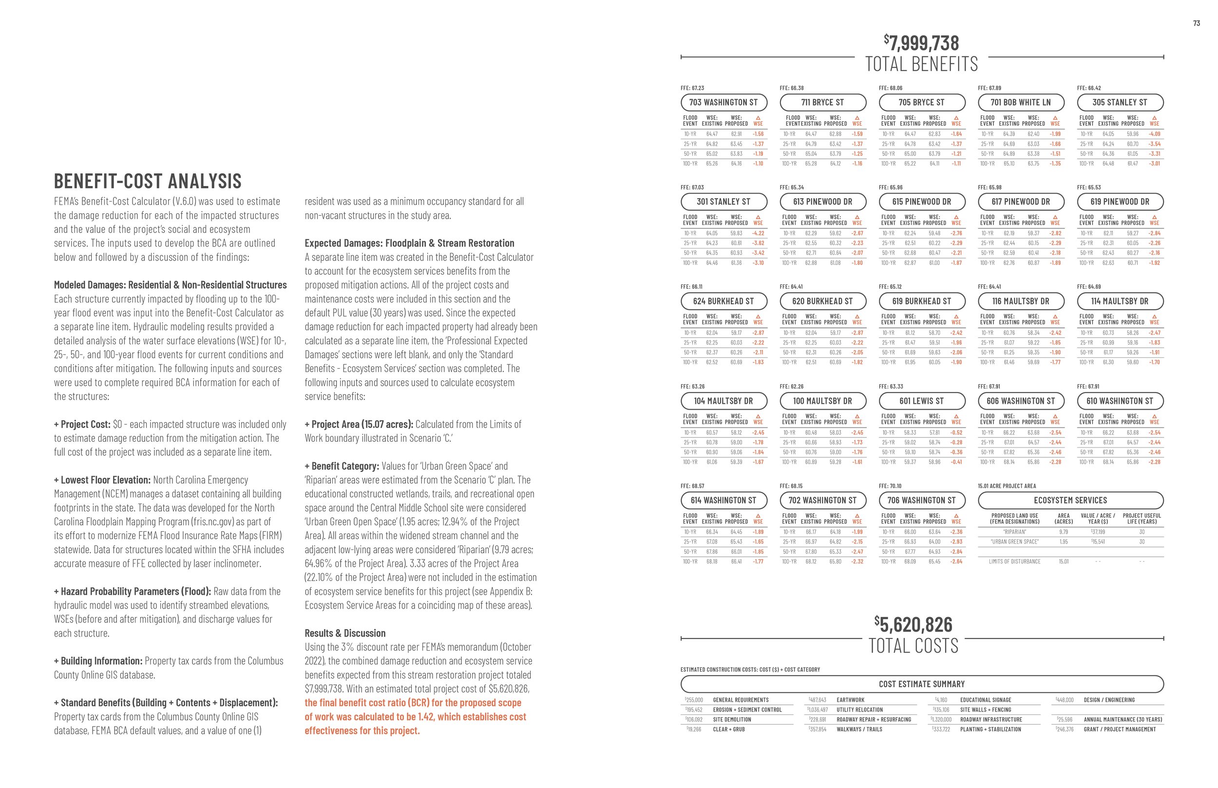
Mollie’s Branch: Stream Restoration & Infrastructure Improvements
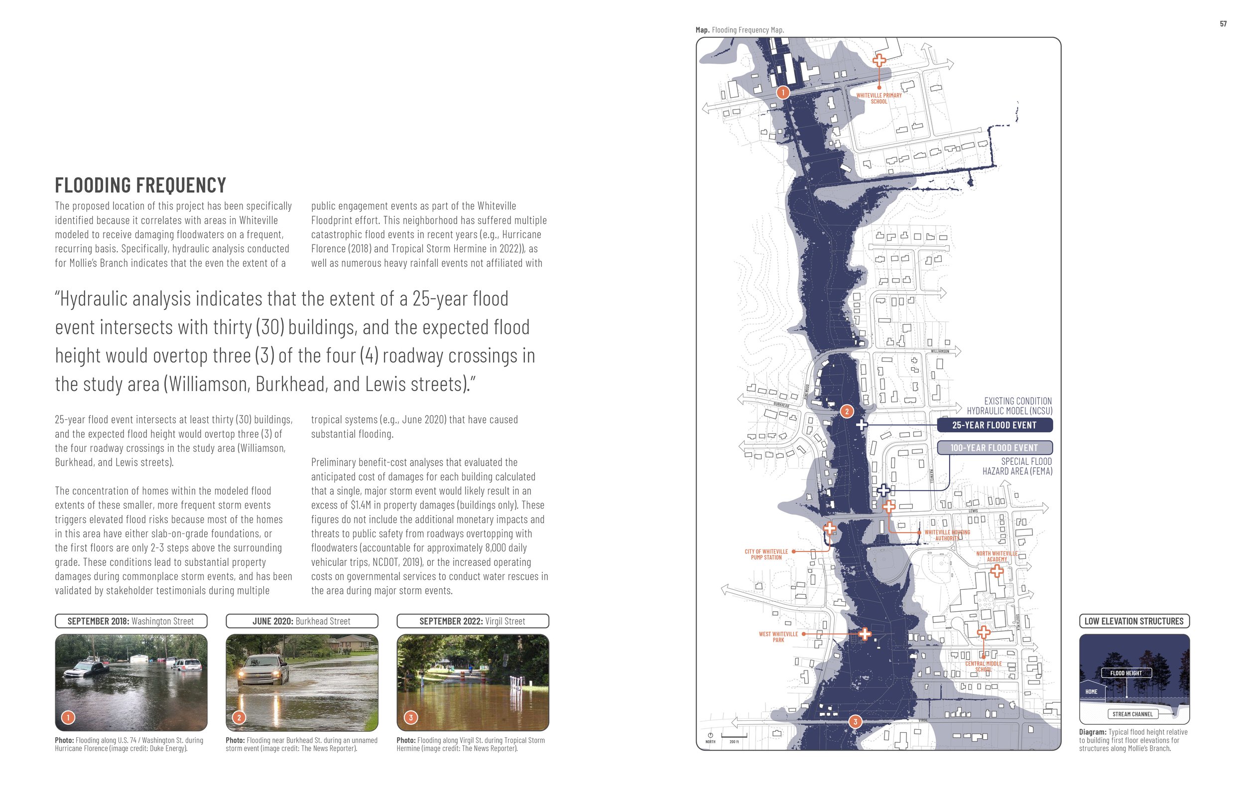
The neighborhood surrounding the Mollie’s Branch stream corridor is a historically underserved community of color that was, and continues to be, disproportionately impacted by floodwaters. This focus area observes increased vulnerabilities due to: i) a high concentration of buildings within the 100-year floodplain; ii) multiple roadways that regularly overtop with floodwaters due to low elevation and/or undersized culverts; and iii) socioeconomic factors that correlate with a historical lack of investment in resilience-building projects.
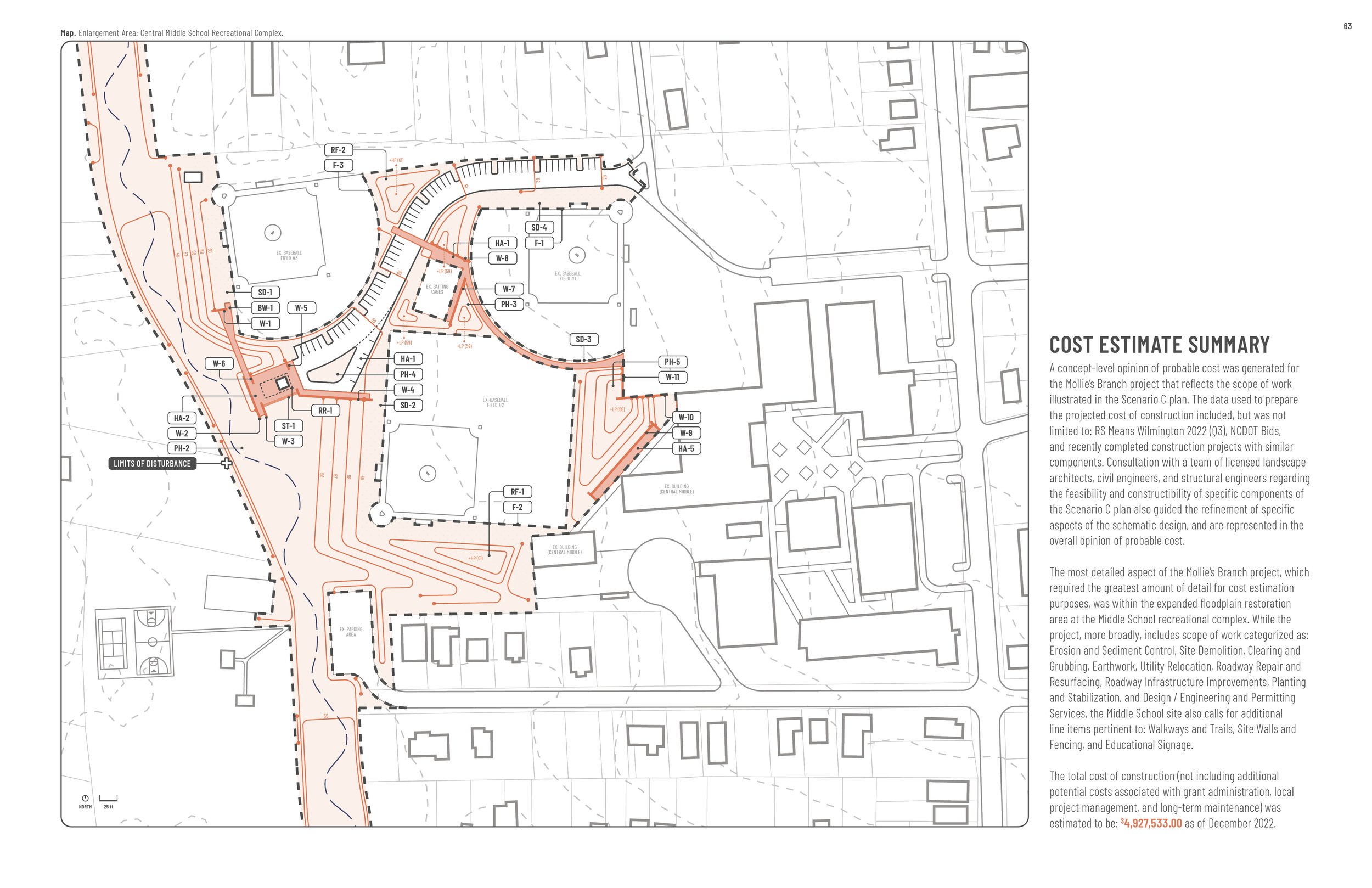
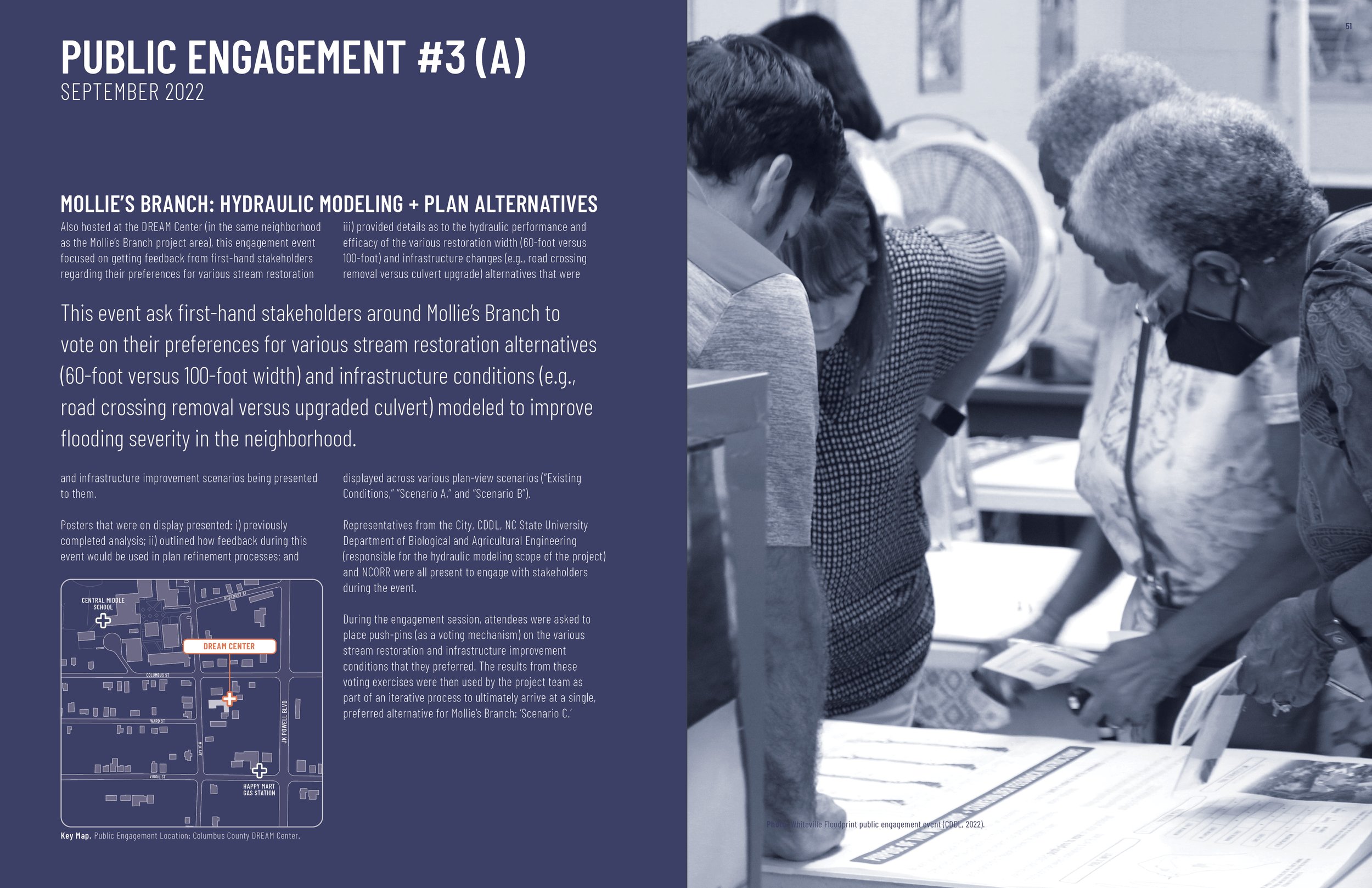
The proposed combination of “green” and “gray” infrastructure enhancements includes 5,100 linear feet of stream restoration, four roadway modifications (e.g., upgraded culverts) at locations where Mollie’s Branch passes beneath existing roads, and an expanded educational wetlands area within the Central Middle School recreational complex.
Already, this project has: i) been awarded a grant from the Golden LEAF Foundation to assist with additional surveying, design, and engineering costs; and ii) is currently under review for the FY2023 FEMA Building Resilient Infrastructure and Communities (BRIC) grant program, where a state-level review board ranked and prioritized the project as #1 (out of 82 initial subapplications) in the State of North Carolina for FEMA to consider.
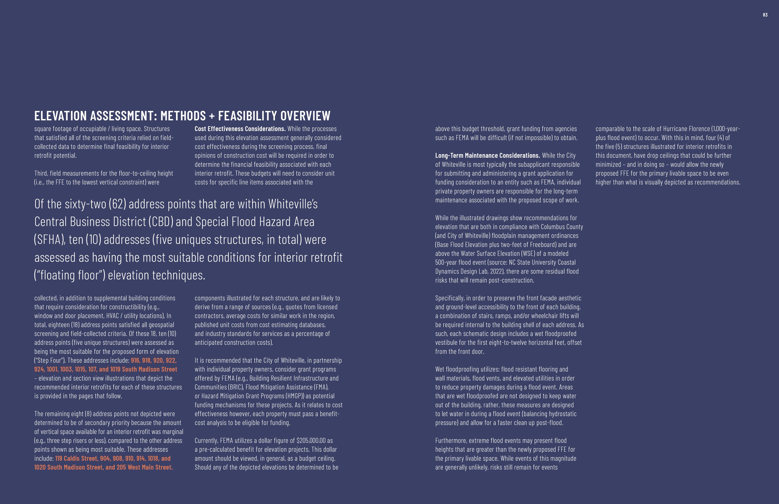
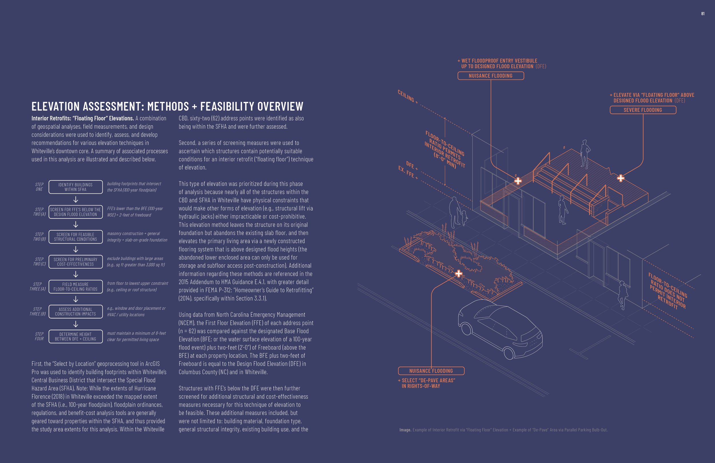
Downtown Core: Interior Retrofits / Elevations & “De-Pave” Program
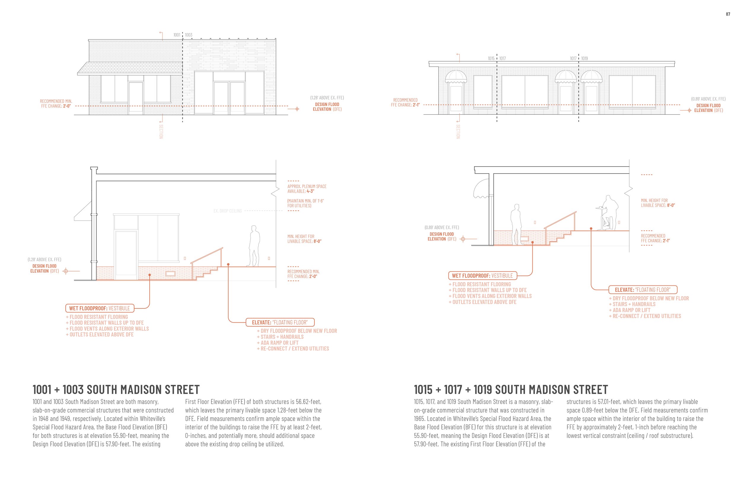
Sixty-two (62) address points were assessed as being within Whiteville’s Central Business District (CBD) and Special Flood Hazard Area (SFHA). Each of these structures was screened through geospatial criteria and field-collected data to determine which buildings: i) are currently not in conformance with the Columbus County Flood Damage Prevention Ordinance (Base Flood Elevation (BFE) of a 100-year flood event plus an additional two-feet of Freeboard); and ii) may be suitable for elevation as a mitigation strategy. Because slab-on-grade structures are prevalent throughout the CBD, an interior retrofit (“floating floor”) elevation was analyzed at the building-by-building level of detail.
Of the 62 address points screened, ten (10) addresses (five unique structures) were determined to have the most suitable conditions for this specific form of elevation. Section and elevation drawings for each building are provided in the report to illustrate how the proposed interventions fit within the existing building shell.
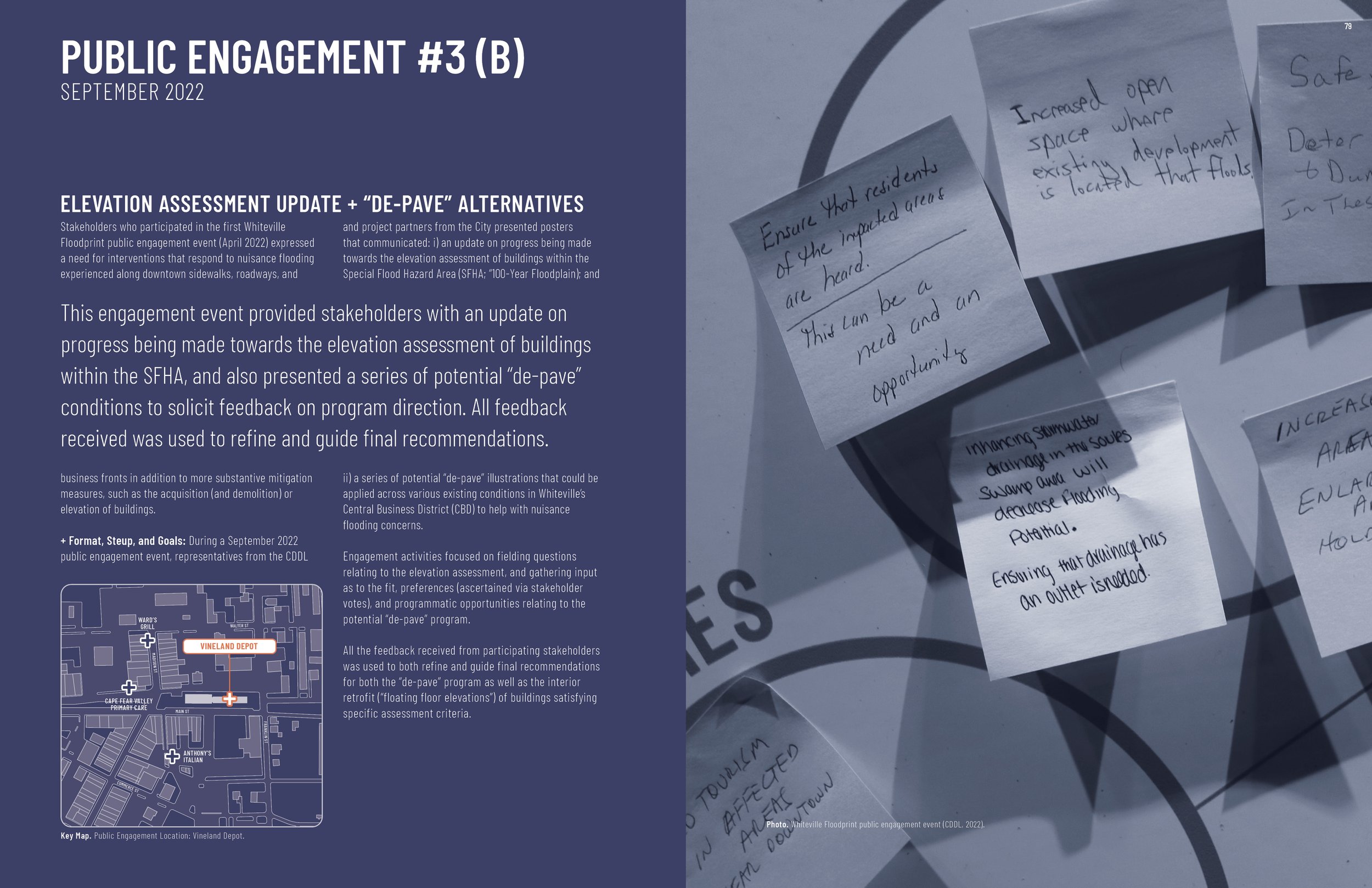
In addition to the elevation assessment, a second measure is proposed for the Whiteville CBD: a “de-pave” program. While not intended to significantly mitigate damages from severe flooding events (e.g., 500-year events), the “de-pave” proposal is a more broadly applicable response to stakeholder concerns about nuisance flooding along roads and business fronts in the downtown area. By reducing the total area of paved surfaces in downtown Whiteville by converting underutilized hardscape areas into green infrastructure, a network of small-scale interventions can better absorb stormwater while also beautifying the streetscape.
A summary of the final report was presented to Whiteville’s City Council on May 23, 2023. At the conclusion of the presentation, the City Council voted unanimously to formally adopt the Whiteville Community Floodprint report. The agenda packet provided to the City Council, the meeting minutes, and the adopted report are all available for download on the City of Whiteville website.
Sample Images
Project Start Year
2022
Client
City of Whiteville
Location
City of Whiteville
Collaborators
Hydraulic Modeling: Barbara Doll, PhD, PE, and Jack Kurki-Fox, PhD, PE
Cost Estimating: Gresham Smith
Full Report
Awards
2023 Award of Merit in Social Impact: Recovery, Restoration, Resilience: The Whiteville Community Floodprint, American Society of Landscape Architects Southeast Regional Conference
Funding Sources
North Carolina Office of Recovery and Resiliency (NCORR) / U.S. Department of Housing and Urban Development (HUD) CDBG-Mitigation Grant