
NC Riverine ResilieNCe Study

Identifying Natural Infrastructure Opportunities in the Middle Neuse Watershed
Project Summary
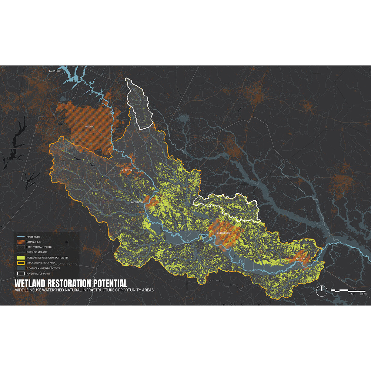
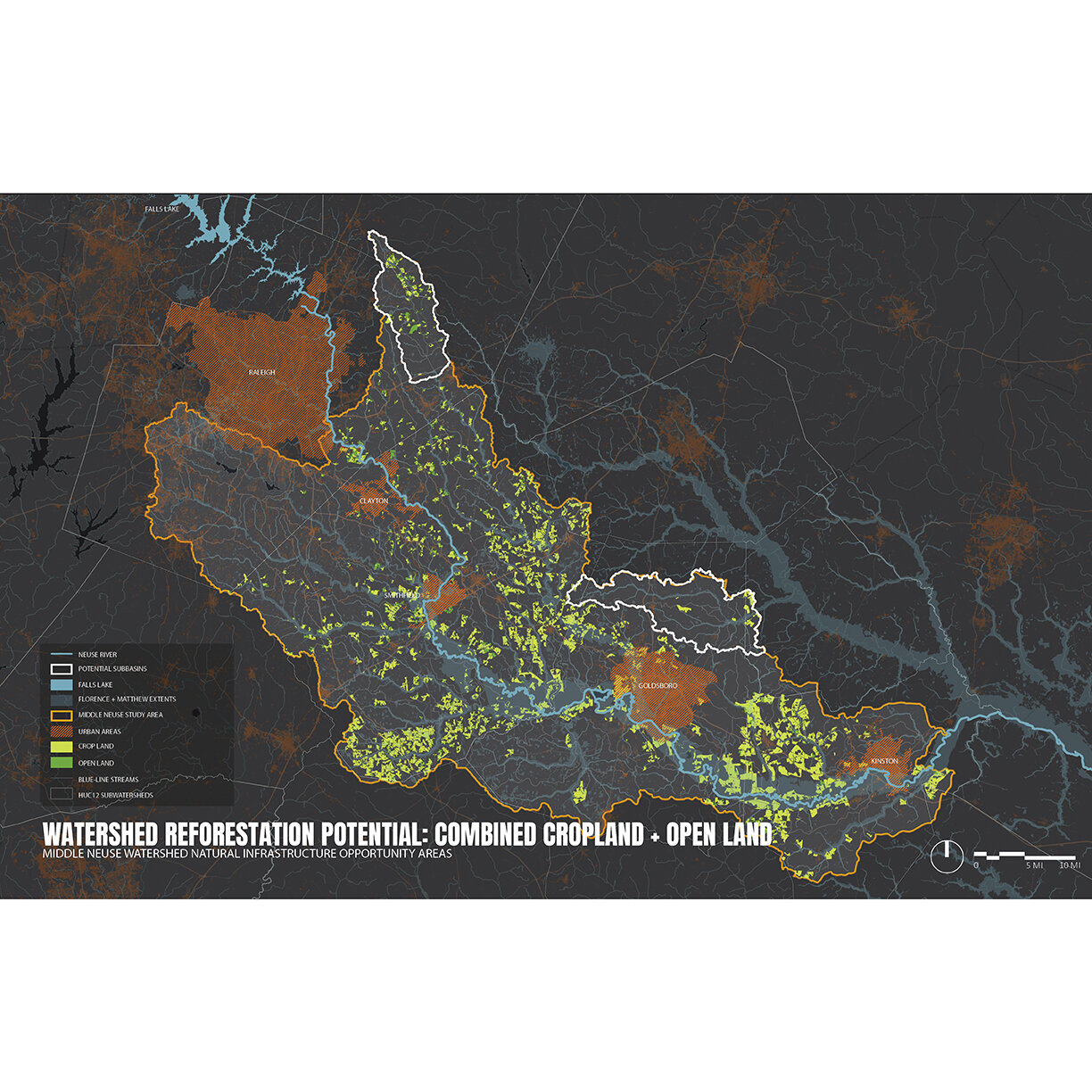
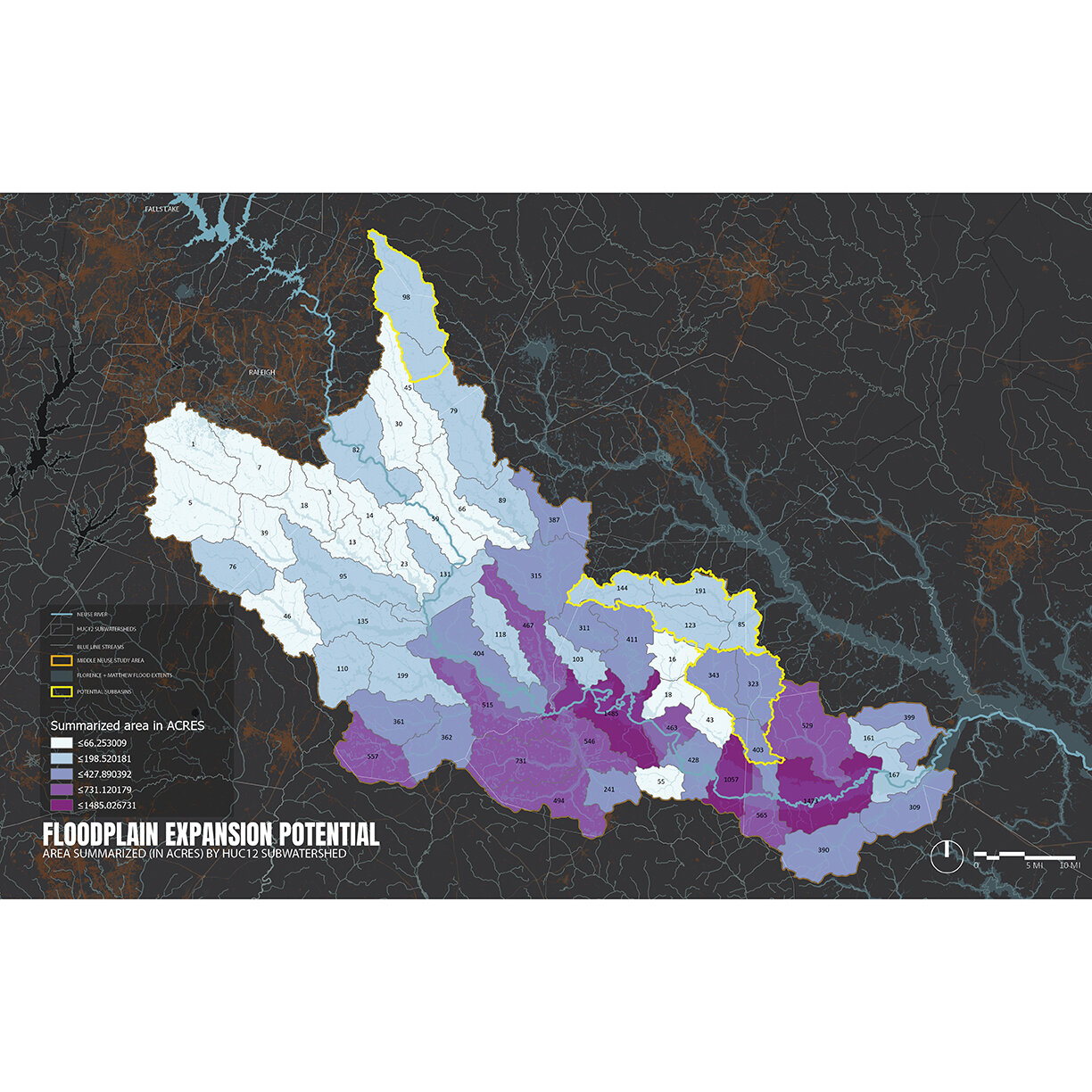
Working within a multidisciplinary, inter-institutional research team led by NC Sea Grant and NC State Biological and Agricultural Engineering, the CDDL conducted geospatial analysis to identify areas where strategic natural infrastructure practices can be located in the Neuse River Basin to reduce flooding and provide water quality and habitat improvement. The study assessed the flood storage potential for areas that experience repeated flooding and include converted wetlands, residential and commercial structures, large land parcels, agricultural operations, transportation routes, and population centers. Soil type, vegetation cover, land use, and slope were key variables. Specific infrastructure opportunities that were analyzed include:
Wetland Restoration
Watershed Reforestation
Floodplain Expansion
Water Farming
Restoration of Incised and Entrenched Streams
For more information about this project and the larger N.C. Coastal Rivers Flood Mitigation initiative, please visit this link.
Sample Images
Collaborators
NC Sea Grant
NC State Biological and Agricultural Engineering